

A bomb-filled ‘doomsday wreck’ which threatens to unleash a tsunami in the Thames is edging closer to collapse, an ominous new survey of the ship reveals.
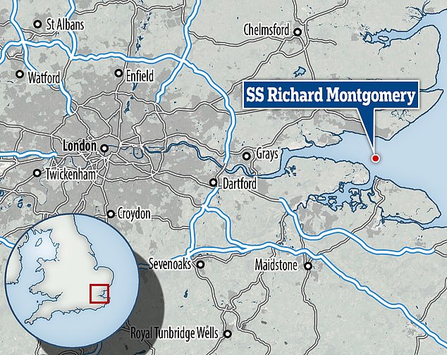
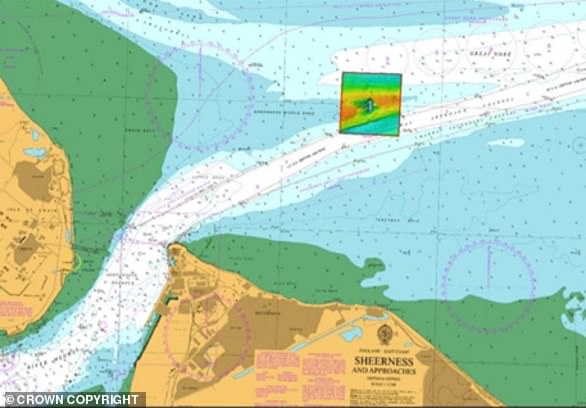
The SS Richard Montgomery sank in the Thames Estuary near Sheerness, Kent, in August 1944, taking 1,400 tons of WW2 explosives to the bottom.
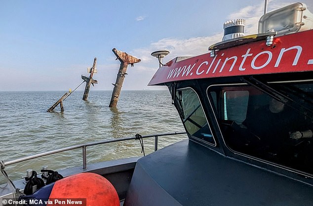
Her masts still loom above the water line and there are plans to remove them, lest they collapse on to the wreck and trigger an explosion.
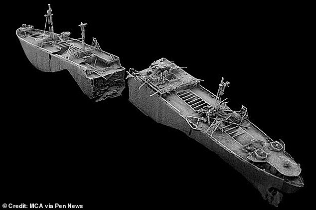
But a new survey of the ship has revealed the hull itself is deteriorating, with several alarming changes detected in the year since the last survey.
Now a no-fly zone has been imposed at the wreck site by the Department for Transport, banning civilian and non-emergency aviation from the skies overhead.
One problem flagged up by the survey is that the front half of the ship – which broke in two as it sank – is slowly tipping over, tilting half a metre further eastward in two years.
More decay was observed in the second cargo hold, where the upper port side has cracked, and the lower starboard side has become ‘significantly buckled’.
This has caused part of the deck above to start collapsing into the hold, with the hatch supports in this area dropping by up to 17cm in a year.
A bomb-filled ‘doomsday wreck’ which threatens to unleash a tsunami in the Thames is edging closer to collapse, an ominous new survey of the ship reveals
The SS Richard Montgomery sank in the Thames Estuary near Sheerness, Kent, in August 1944, taking 1,400 tons of WW2 explosives to the bottom
All told, it looks like ‘the forward part of the wreck is splitting in two,’ the new report states.
The back end of the wreck is in similar trouble.
The survey says: ‘Like the forward section, the rear section is hogging and potentially breaking in two about halfway along its length.’
Further deterioration was detected where the front and back of the wreck split apart.
‘This area was left unsupported when the ship broke in two back in 1944,’ the report says.
‘Consequently, it has been badly affected by wave and current action and is steadily collapsing and falling into the gap between the two halves of the vessel.’
If the seabed is anything to go by, the worst is yet to come.
The report warns: ‘The degree to which the bow and stern may be being undercut as the supporting sediment is eroded away is a potential concern.’
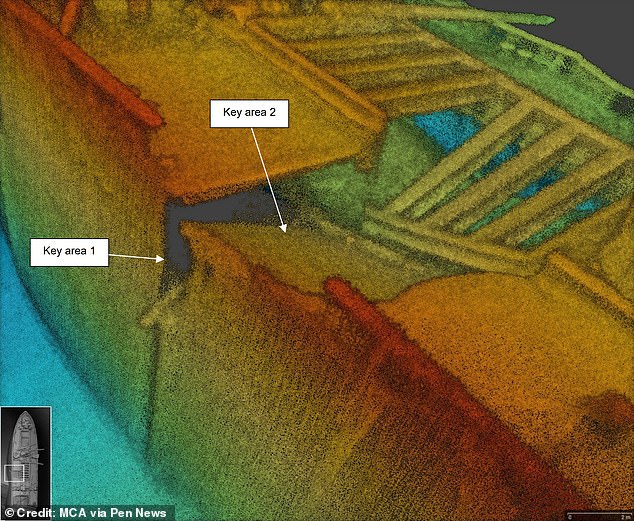
One area of seabed close to the wreck was found to have dipped by 1.6m in a year. The front of the ship has now been ‘undercut to the degree where it has started to move’, according to the findings
All told, it looks like ‘the forward part of the wreck is splitting in two,’ the new report states. The back end of the wreck is in similar trouble
The SS Richard Montgomery sank off Medway in Kent and has lain on the seabed for nearly 80 years
One area of seabed close to the wreck was found to have dipped by 1.6m in a year.
The front of the ship has now been ‘undercut to the degree where it has started to move’, according to the findings.
A 1970 report from the Royal Military College of Science predicted what would happen if the whole explosive cache detonated at once.
It would unleash a column of water and debris 3,000 metres high, and a five-metre tsunami, engulfing nearby Sheerness, the report said.
Also in the firing line is Southend, which lies some five miles north of the wreck site.
Daniel Cowan, leader of Southend Council, is looking for answers.
He said: ‘According to the experts, the wreck of the Montgomery remains stable.
‘So I understand that the no-fly zone that’s been put in is a precautionary measure.
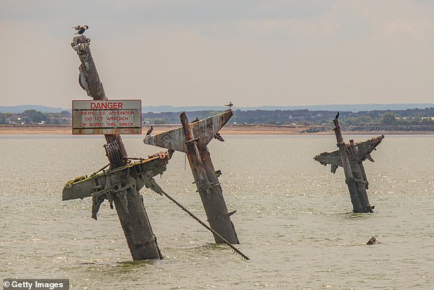
Her masts still loom above the water line and there are plans to remove them, lest they collapse on to the wreck and trigger an explosion
SS Richard Montgomery was an American Liberty cargo ship. The ship was wrecked on the Nore sandbank in the Thames Estuary, near Sheerness, Kent, England, in August 1944
‘But we are seeking further clarity around the long term plans for the wreck.
‘What we’d like more than anything is clarity, to understand what the long-term plans are.’
The Department for Transport, the ministry responsible for the wreck, said the no-fly zone had been implemented on expert advice and would remain in place until further notice.
A spokesperson said: ‘Our priority will always be to ensure the safety of the public and to reduce any risk posed by the SS Richard Montgomery.
‘The condition of the wreck remains stable, and experts are continuing to monitor the site.
‘As part of their ongoing monitoring, they have updated advice on how authorities can further minimise risk.
‘They have recommended that pilots and operators do not fly in a limited area around and above the site as specified by the Civil Aviation Authority.’
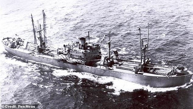
The SS Richard Montgomery, which lies at a depth of 49ft, was an American vessel carrying munitions for the allies in the Second World War.
She ran aground on a sandbank and broke her back on it when the tide went out, sinking before all of her cargo could be recovered.
What is the SS Montgomery and why is it dangerous?
The SS Richard Montgomery was a US Liberty Ship built in 1943 to transport cargo across the Atlantic
The 7,200-tonne vessel safely crossed the Atlantic on convoy HX-301 without incident and was ordered to anchor off Sheerness.
The vessel was carrying some 7,000 tonnes of munitions and it was due to carry on to Cherbourg to unload its cargo.
However, on August 20, 1944, the Montgomery dragged her anchor and ran aground on a sandbank around 250 yards from the Medway Approach Channel.
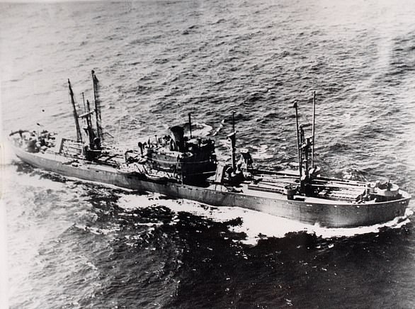
The SS Richard Montgomery, pictured, sank in 1944 off the coast of Kent carrying 7,000 tonnes of munitions that were due to be shipped to Cherbourg for invasion of Europe
The SS Richard Montgomery dragged its anchor on August 20, 1944 and ran aground on a sandbank before her hull cracked and started flooding
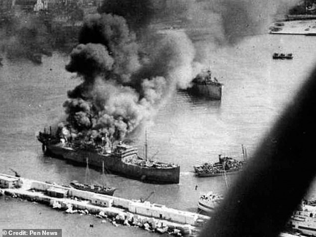
A major salvage operation was launched to unload the vessel’s deadly cargo although, within 24 hours cracks began appearing across the hull and the forward areas began flooding.
By September 25, the salvage operation had to be abandoned after the entire vessel flooded.
The Richard Montgomery was one of 2,700 Liberty ships built during the war.


