More than a quarter of a million households are living under some of the worst aircraft noise in Britain, a shocking new study has revealed – and experts warn the misery may only just be beginning.
The Daily Mail has ranked every postcode district in England, Scotland and Wales by aircraft noise exposure, exposing the areas where residents suffer the greatest ‘flight blight’.
The findings paint a grim picture for thousands of families living beneath Britain’s busiest flight paths, with South London‘s Kennington named the single worst-affected district in the country, scoring a dire 0.6 out of 100.
And the capital dominates our list of the 250 worst-hit postcodes, with eight of the top 10 districts in London.
The blight, however, stretches far beyond the M25 with the Manchester Airport corridor among the worst affected, while Bristol, Edinburgh, while even seemingly tranquil rural areas in Oxfordshire, Surrey and Essex make the list.
The analysis, carried out by My Flight Path for the Daily Mail, comes as Britain’s airports handled a record 302 million passenger journeys in 2025 – the highest figure ever recorded.
At the same time, major expansion plans at Heathrow, Gatwick, Luton, Stansted and a number of regional airports could unleash an extra 600,000 extra flights a year into UK skies.
Experts say that means communities already suffering the worst aircraft noise in the country may be facing an even bleaker future.
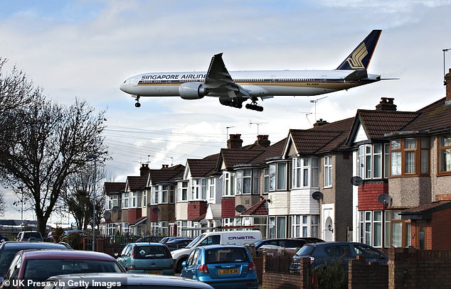
Pictured: A plane flies low over homes in south London on its approach to Heathrow Airport. Postcodes in Southall and Staines were ranked among the worst affected
Kennington in London was named the single worst-affected district in the country for aircraft noise, scoring a dire 0.6 out of 100.
Jono Oates, co-founder at My Flight Path said: ‘With UK airports on course to handle hundreds of thousands more flights per year, the communities at the bottom of our rankings face the prospect of conditions deteriorating significantly.
‘What’s already the worst aircraft noise in Britain could get meaningfully worse.
‘The record passenger numbers we saw in 2025 are not a blip – they reflect the structural growth of aviation.
‘That growth has a geography and the people living beneath it deserve to know what they’re dealing with and what’s likely coming.’
Using millions of aviation data points, researchers produced a Flight Blight Rating from 0 to 100, with lower scores indicating worse exposure.
Every one of the 250 lowest-ranked postcode districts was classed as ‘critical’ – the most severe category.
Each scored 17 out of 100 or lower, compared with a national average of 61.
Eight of the worst areas were recorded in London with the SE11 postcode of Kennington and Vauxhall in London scoring just 0.6.
SW18 in Wandsworth scored 0.7, SE24 in Herne Hill scored 0.8 and well-heeled SW5 – West Brompton and Earls Court – registered 0.8.
All sit under Heathrow’s intensely busy flight path.
Affluent Cheadle in Cheshire – which has the SK8 postcode – was the worst ranked area outside of the capital, scoring 1.0 for flight blight caused by Manchester airport.
The BS10 postcode for Brentry and Southmead in north Bristol scored 1.1, while OX49 – for Watlington in Oxfordshire – scored 1.1.
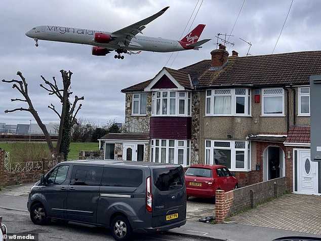
Planes come into land on Myrtle Avenue in Feltham which is located right next to Heathrow Airport
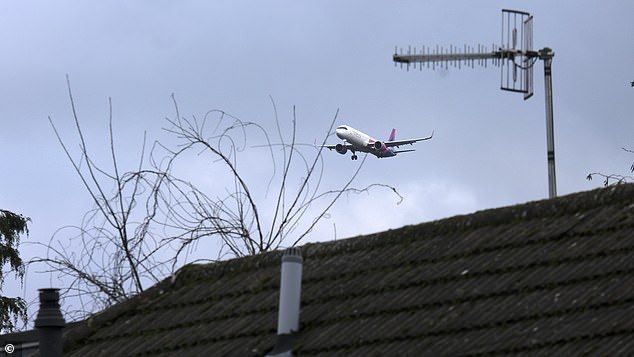
Postcodes located close to Gatwick Airport were also badly affected, including RH7 in Lingfield, Surrey. Pictured: A plane comes into land over nearby Shipley Bridge
Other critical flight blight postcodes included RH7 in Lingfield, Surrey (1.2) – which lies on the Gatwick flight path – and CM23 in Bishops Stortford, Herts (1.3) near Stansted.
Luton North – LU2 – received a rating of just 1.4 for its proximity to the town’s airport. While the B26 postcode for Sheldon and Yardley, in the West Midlands, is the most affected area for flight traffic to and from Birmingham (1.5).
Homes under flight paths face tens of thousands wiped off the value of their homes.
Research suggests property values decrease by half a percent for every decibel of aircraft noise above ambient levels of 40 to 45dBA. A 10% increase in decibels could equate to a 6% drop in property prices.
Thamesmead, east London, is earmarked for 15,000 homes. However, because it is directly in line with City Airport’s runway, homeowners risk losing between £70,000 and £84,000 on a £350,000 property.
Mr Oates said: ‘For homes under busy flight paths, where noise exposure is consistently elevated, that can equate to a 9-12% reduction in property value – tens of thousands of pounds off a typical UK home.’
The company, which provides detailed flight path analysis to prospective house-buyers similar to flood risk surveys, said those living under flight paths not only face noise irritation and potential falls in property value but also heath issues.
Mr Oates said: ‘Significant evidence links chronic aircraft noise exposure to serious health consequences.
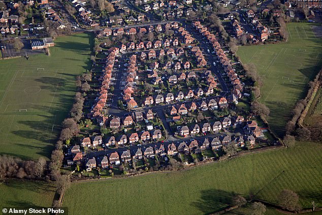
Cheadle in Cheshire was ranked the worst area for airport noise outside of London
‘One recently published study found that significant noise increases – of the kind experienced in communities beneath busy flight paths – were associated with a 12.4% increase in stroke incidents, even after accounting for air pollution.
‘The World Health Organisation has ranked environmental noise, with aviation prominent among its sources, as one of the top public health risks after air quality.
‘Researchers have established that aircraft noise uniquely fragments sleep cycles, triggering hormonal stress responses and sustained cardiovascular strain.’
‘For the communities at the top of our rankings – Kennington, Peckham, Wandsworth, Southall – this is not a theoretical concern. It is a nightly reality.’
Of the worst-affected 250 postcodes, 233 (93%) are within 25km of a major commercial airport.
Holding patterns, approach paths, and departure routes extend 15 to 25km from airport runways, and aircraft in these zones are typically between 2,000ft and 15,000ft.
Seventeen postcodes in the 250 are more than 25km from any major commercial airport.
Six are near military bases, four are near busy flying schools, five are under extended aircraft approach ‘corridors’ and two postcodes are affected by multiple sources.
Following government approval of Heathrow’s £49 billion third runway expansion and with Gatwick, Luton and Stansted finalising their own, the UK’s total annual flight movements could rise from 2.7 million to 3.3 million.
The Daily Mail previously revealed how families lured into Labour’s flagship New Towns could find themselves living under a relentless barrage of aircraft noise.
The government’s 12 proposed locations for tens of thousands of new homes found 11 are sitting beneath intense flight paths, with noise levels comparable to leaf blowers, diesel lorries and vacuum cleaners.
Two of the sites – in West Yorkshire and in south-east London – will rank among the most flight-blighted places to live in the country.
The warning comes as airports across the UK push for expansion and later operating hours.
Leeds Bradford Airport was used by 4.24 million passengers in 2024, up by 5.8 per cent on 2023.
The number of flights has increased in that period by 6.2 per cent, with an average 87 per day.
Currently the airport is permitted 2,920 take-offs and landings between 23:00 and 07:00 during the summer.
But owners Aena have repeatedly pushed for the cap to be amended to allow more night flights.
The LS19 postcode for Yeadon is the most affected area in the city – with a flight blight rating of 5.1.