

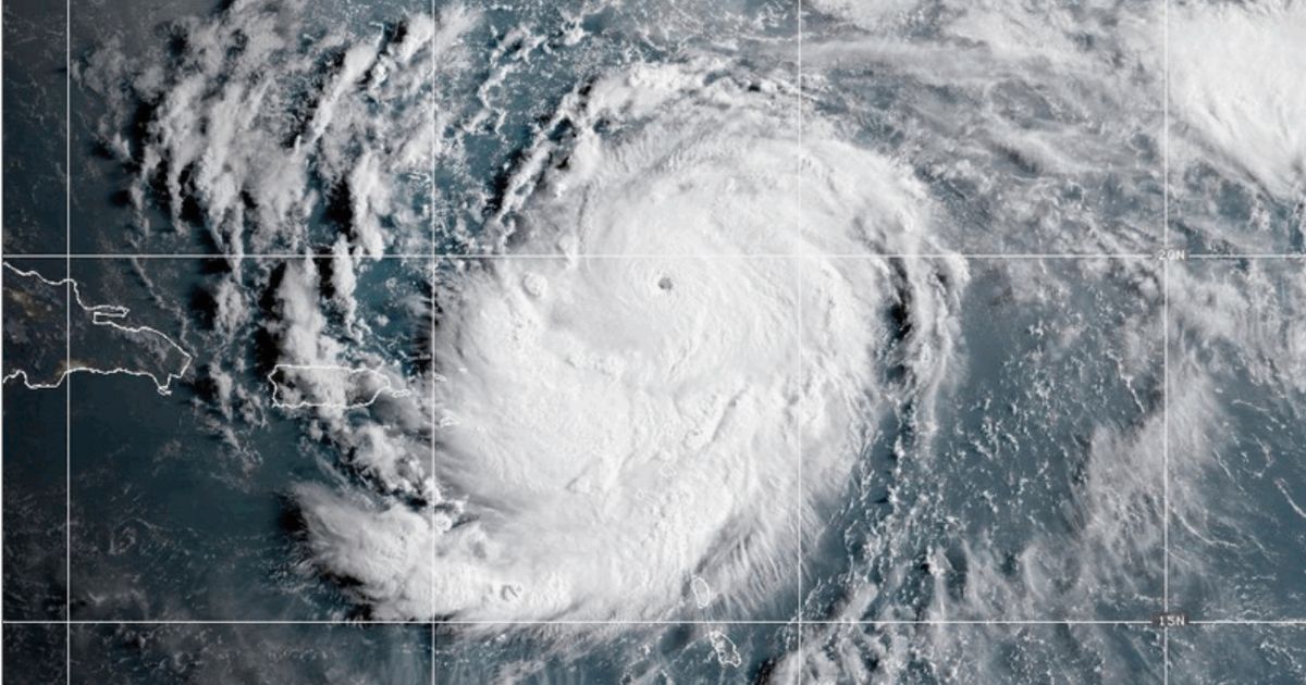
Although Hurricane Erin is not predicted to make landfall along the East Coast, the storm is expected to have widespread impacts.
A Monday advisory from the National Hurricane Center warned of “life-threatening surf and rip currents along the beaches of the Bahamas, much of the east coast of the U.S., Bermuda, and Atlantic Canada during the next several days.”
The advisory warned of tropical storm conditions and coastal flooding beginning on Wednesday in North Carolina’s Outer Banks.
8/18 5pm EDT Hurricane #Erin Key Messages: Tropical Storm Watches and Storm Surge Watches issued for the #NorthCarolina Outer Banks.
See https://t.co/tW4KeGdBFb for more info. pic.twitter.com/OgPAftnzPz
— National Hurricane Center (@NHC_Atlantic) August 18, 2025
“Many of you may assume that with the offshore track of Hurricane Erin over the next several days that there will be little to no impacts to the East Coast of the United States,” National Hurricane Center Deputy Director Jamie Rhome said in a post on X.
“Nothing could be further from the truth for portions of the Mid-Atlantic, especially the Outer Banks of North Carolina.”
He said that on Wednesday and Thursday, “breaking waves of 15 to 20 feet, plus coastal flooding and storm surge could overwash dune and flood homes, flood roads, and make some communities impassable.”
Monday, Aug. 18: NHC Deputy Director Jamie Rhome provides an update on Hurricane Erin’s potential impacts to the east coast of the United States. pic.twitter.com/9Xuza8JR1l
— National Hurricane Center (@NHC_Atlantic) August 18, 2025
Have you ever experienced a hurricane?
Evacuations have already been ordered along the Outer Banks, with officials warning that the road connecting Hatteras Island with the mainland could soon be underwater, according to USA Today.
Early Tuesday, Erin had sustained winds of 115 mph, making it a Category 3 storm. Gusts hit up to 155 mph.
Current predictions estimate the storm will pass between Hatteras Island and Bermuda on Thursday before heading northeast out to the Atlantic Ocean.
Some of the impacts of the storm were felt Monday.
Officials in New Hanover County, North Carolina, said at least 75 rip-current rescues took place Monday on North Carolina’s southern coast, leading to a no-swim order through Friday at Wrightsville Beach, according to CNN.
Cape Hatteras National Seashore officials were warning vacationers that this was the time for caution.
“The Coastal Flood Watch indicates that extreme beach erosion and coastal damage is likely along the oceanside, resulting in a significant threat to life and property. Large, dangerous waves will likely inundate and destroy protective dune structures,” it posted on its website.
“Severe flooding will likely extend inland where there is vulnerable or no protective dune structure, flooding homes and businesses with some structural damage possible. Roads will likely be impassable under several feet of water and vehicles will likely be submerged,” the site warned.
“Life-threatening swimming and surfing conditions are expected, as well as wave action resulting in significant beach erosion,” the warning continued. “Visitors should stay off the beaches completely and discontinue use of all beach trails and boardwalks beginning Tuesday morning.”

Advertise with The Western Journal and reach millions of highly engaged readers, while supporting our work. Advertise Today.


