

England will be hit by thunderstorms tomorrow with parts of the parched country expected to see more rain in several hours than over the whole of last month.
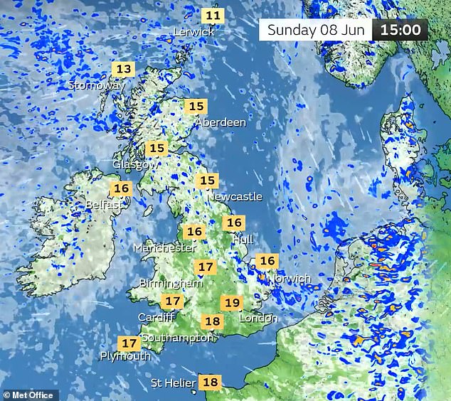
The Met Office has issued a thunderstorm warning for southern England including London as well as the Midlands and South Wales tomorrow from 9am until 6pm.
Up to 15mm (0.6in) of rain could fall in less than an hour, while some places could see 40mm (1.6in) over several hours from successive showers and thunderstorms.
Met Office data shows England had 32.8mm (1.3in) of rain last month, almost half the usual for May average. It was also England’s driest spring since the 1890s.
Frequent heavy showers and thunderstorms are expected for much of tomorrow before fading from the west during the mid to late afternoon, the Met Office said.
Disruption to transport and infrastructure are possible – with meteorologists warning additional hazards will be presented by frequent lightning, hail and strong, winds.
Forecasters said there is a ‘good chance driving conditions will be affected by spray, standing water and/or hail, leading to longer journey times by car and bus’.
Damage to buildings and structures from lightning strikes is also possible, as well as delays to train services, power cuts and flooding of homes and businesses.
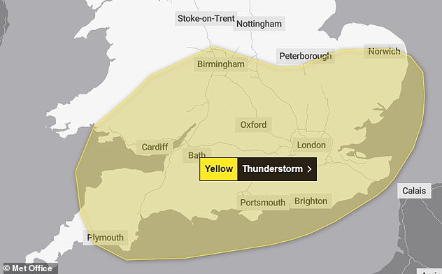
The Met Office yellow thunderstorm warning will be active from 9am until 6pm tomorrow
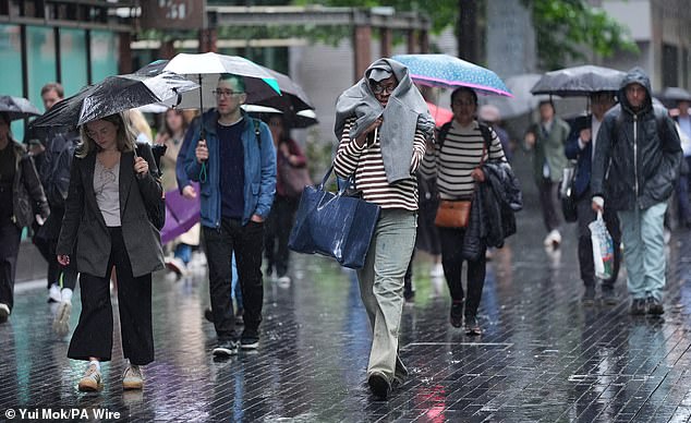
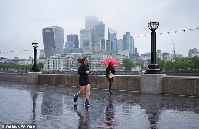
People make their way through the rain in the Southwark area of London yesterday
The Met Office urged those who believe their location could be at risk of flash flooding to ‘consider preparing a flood plan and an emergency flood kit’.
It said: ‘Give yourself the best chance of avoiding delays by checking road conditions if driving, or bus and train timetables, amending your travel plans if necessary.’
Forecasters also said people should prepare for possible power cuts by ‘gathering torches and batteries, a mobile phone power pack and other essential items’.
Those who hear thunder when outside have been advised to find a safe enclosed shelter such as a car, and not to shelter under or near trees or other structures which may be struck by lightning. People on an elevated area should move to lower ground.
Meteorologists are forecasting heavy and frequent showers tomorrow, with hail and thunder possible and some unseasonably strong winds in coastal areas.
There could also be a risk of surface-water flooding, and the Met Office said there could be ‘challenging driving conditions’ for motorists in some parts of the country.
Gales are likely across many southern coasts and possibly inland for a period with gusts of up to 50mph, and forecasters warned: ‘Be aware if making outdoor plans.’
From June 1 to June 3 there had already been 10.7mm (0.4in) of rain, a fifth of the 50.9mm (2in) recorded for the UK during May.
Sunday looks to be drier and the better day of the weekend, before further rain in northern England on Monday.
Meteorologist Honor Criswick said the wet weather was because of low pressure.
She said: ‘At the north of the country this brings in a north-westerly wind, so gradually drags in frontal systems out from the west and south-west, and that leads to some pretty changeable and wet weather at times.’
Next week temperatures will rise to above average for the time of year, with highs of 25C (77F) next Wednesday in London and 23C (73F) in Manchester.
The National Farmers’ Union (NFU) said the change in weather would be welcomed by many farmers.
Rachel Hallos, NFU vice president, said: ‘After such a dry start to the year, this weekend’s rainfall will be welcome in many areas.
‘However, heavy downpours aren’t the ideal way to restore soil moisture, what farmers really need is steady, consistent rainfall to support crops and grazing without causing run-off or damaging soils.
‘These changing weather patterns, from long dry periods to intense bursts of rain, highlight the need for long-term planning and investment in water, particularly the water we need to produce the food we enjoy.
‘Things like rainwater harvesting and more flexible abstraction rules are important steps in adapting to these new conditions.’
Luke Hindle, duty manager for National Highways, urged drivers to plan journeys carefully.
He said: ‘Rainfall makes the surface of the road slippery, so increase the gap between yourself and the vehicle in front and keep your eyes on the road at all times as visibility can be reduced.’
It comes after provisional Met Office figures released on Monday showed the UK has recorded its warmest spring on record and its driest in more than 50 years.
People run or walk through the rain on The Queen’s Walk on London’s South Bank yesterday

People shelter from the rain as they punt along the River Cam in Cambridge yesterday
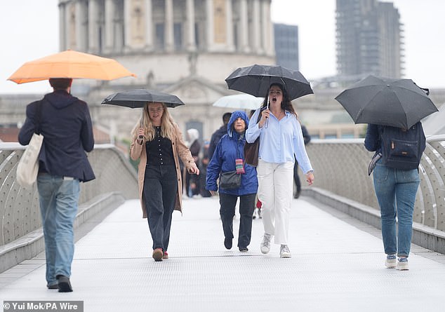
People with umbrellas walking along the Millennium Bridge in London in the rain yesterday
The three months from March to May were also the sunniest spring on record for the UK.
Millions of households have been warned they could face hosepipe bans this summer without sustained rainfall.
Drought has already been declared in north-west England, and four other areas – the North East, Yorkshire, East and West Midlands – are also experiencing prolonged dry weather, the Environment Agency has said.
While Youlgrave Waterworks, a private firm which supplies 500 homes in Derbyshire, became the first to introduce a hosepipe ban at the start of June, major water companies say they have no current plans to bring in bans but are keeping it under review.
But the national drought group, which met yesterday, heard that without further substantial rain some water companies may need to implement drought measures this summer to conserve supplies.
The Environment Agency also said it had been the country’s driest spring since 1893.
Last month Thames Water executives said they were ‘not confident’ they could avoid bringing in restrictions for their 16 million customers this summer, as it would depend on how much rainfall the region received in the coming weeks.


