ISLANDS aren’t all just sun, sea and sand.
There’s some creepy outcrops lurking around the world – and some you can only visit on Google Maps.
6
6
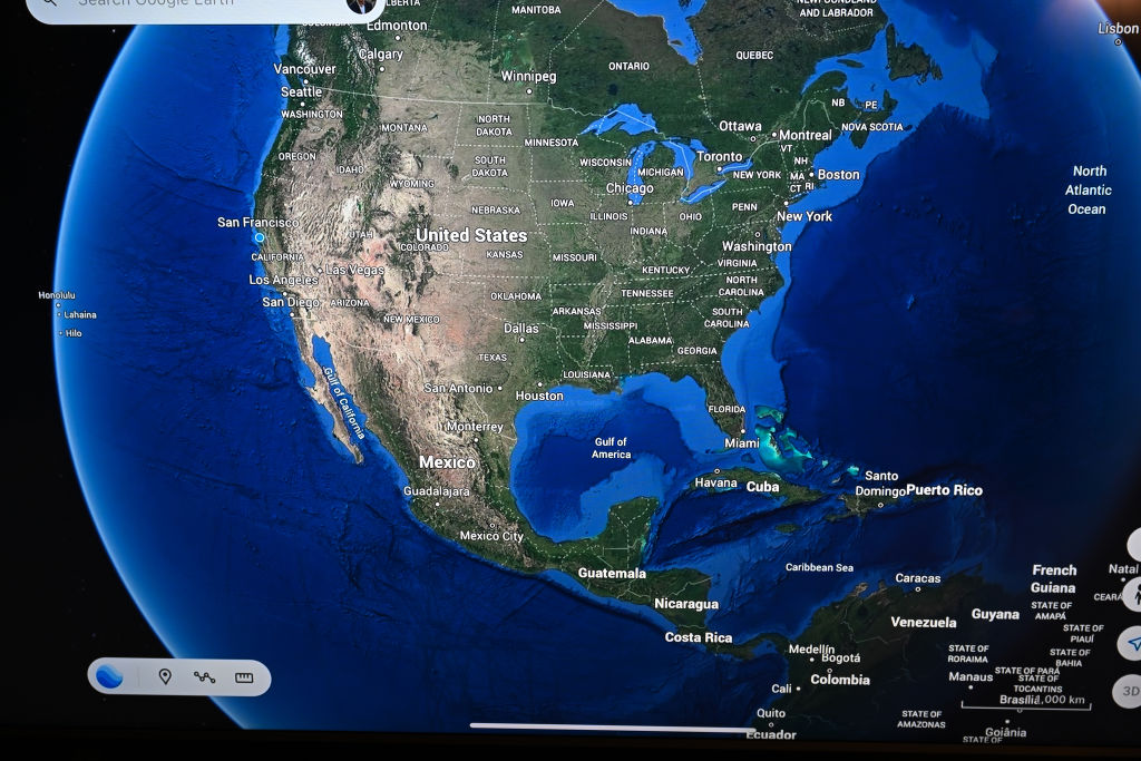
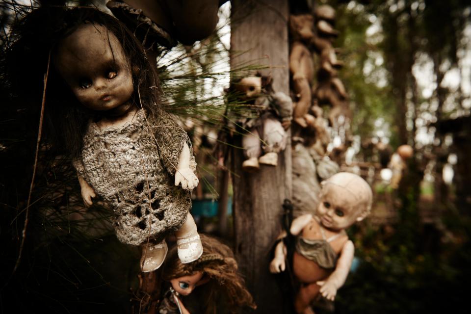
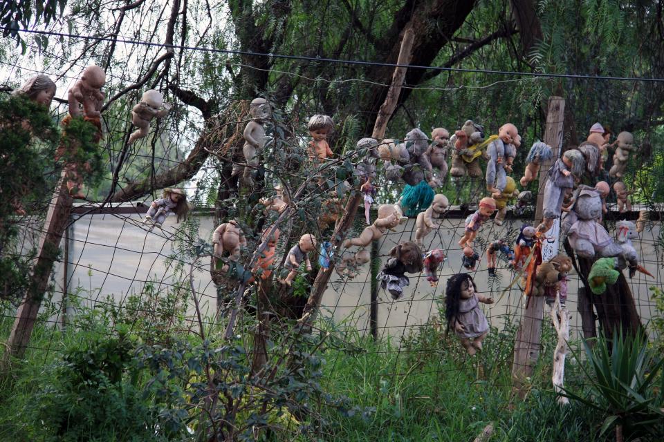
The Island of the Dolls in Mexico
The Island of the Dolls, or La Isla de las Munecas as it’s known locally, is located in the Xochimilco canals south of Mexico City.
The artificial island houses a few small huts, which are outnumbered by thousands of decaying dolls.
According to Guinness World Records, it is home to the world’s largest collection of ‘haunted’ dolls.
It is said that the caretaker of the island, Don Julian, began building the collection after attempting to save a girl who drowned nearby.
In an attempt to ward off her spirit, Julian hung dolls from the trees.
Soon enough, he became something of a local legend, and people began bringing more dolls to add to the collection.
Google Maps coordinates: 19.2902° N, 99.0965° W
6
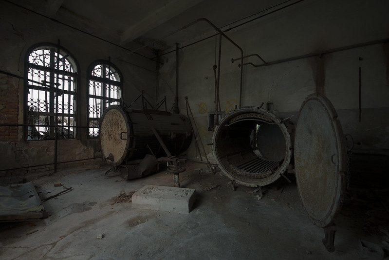
Ghost Island in Venice
The Ghost Island of Venice, known officially as Poveglia Island, has been largely uninhabited since the 1300s.
Since then, the island has been the site of several hospitals, which may have contributed to the island’s reputation.
For over a century, the spit of land was used as a quarantine for those suffering with the plague and other diseases.
Today, it is mostly home to some abandoned buildings, which has helped earn its name as one of the most haunted spots in Italy.
Poveglia Island is not open to the public, although special permits are occasionally granted.
Google Maps coordinates: 45°22′55″N 12°19′52″E
6
6
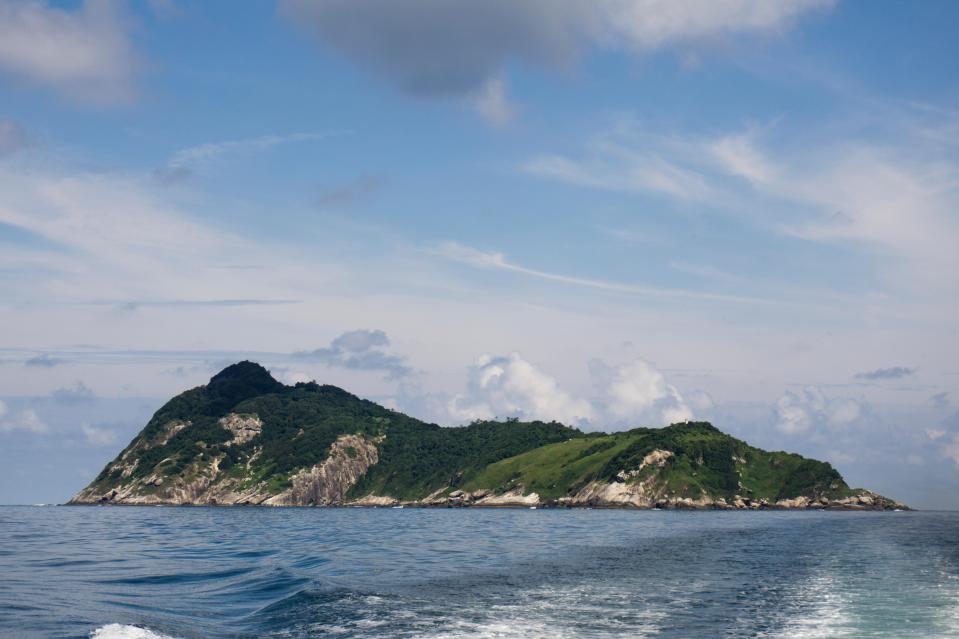
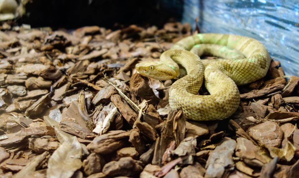
Snake Island in Brazil
The forbidden island of Brazil’s Ilha da Queimada Grande, or Snake Island, is one only scientists and soldiers can visit.
The location is famous for its abundance of venomous snakes – and no ordinary snakes at that.
The golden lancehead, which call this island home, is a species of pit viper found nowhere else in the world.
Experts believe the species was cut off from the mainland 11,000 years ago, and has been evolving in isolation ever since.
Google Maps coordinates: 24°29′10″S 46°40′30″W
6
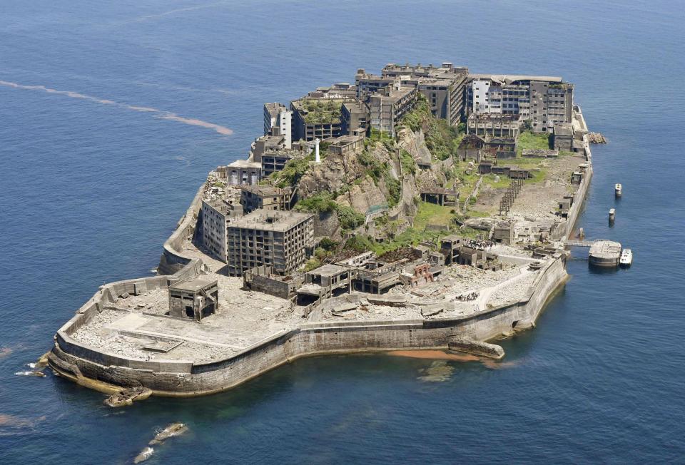
Hashima Island in Japan
The abandoned Hashima Island, otherwise known as “Gunkanjima” or “Battleship Island”, served as a critical wartime coal mine from the time it was purchased by Mitsubishi in 1890.
Under gruelling conditions, Korean and Chinese prisoners were forced to build towering concrete towers on the island beginning in 1916, in which workers would eventually live.
Up to 1,300 conscripted labourers died on Hashima due to underground accidents, exhaustion, and malnutrition.
After the war, its population spiked to an astonishing 5,300 people who were crammed into the 480-metre-by-160-metre accommodation.
At its peak, the island was a hub of national coal mining, along with a hospital, schools, shops, and even a temple and a shrine.
But the mines were eventually closed in 1974, leaving Hashima abandoned for 40 years to be reclaimed by nature.
Google Maps coordinates: 32°48’30.59″N 129°49’30.10″E