A freak storm has battered an Italian holiday hotspot – with torrential rain triggering severe flooding and turning roads into raging rivers.
Dramatic footage posted to social media show roads have been turned into raging rivers, with cars floating down village streets and water engulfing vehicles.
The footage was taken in the towns of Agrigento and the San Leone, whose residents have been unable to leave their homes.
At least one person is thought to have been swept away in the floods.
Local authorities believe she disappeared today while trying to leave her car, which had become stuck because of the torrential rains.
Emergency services are still searching for her.
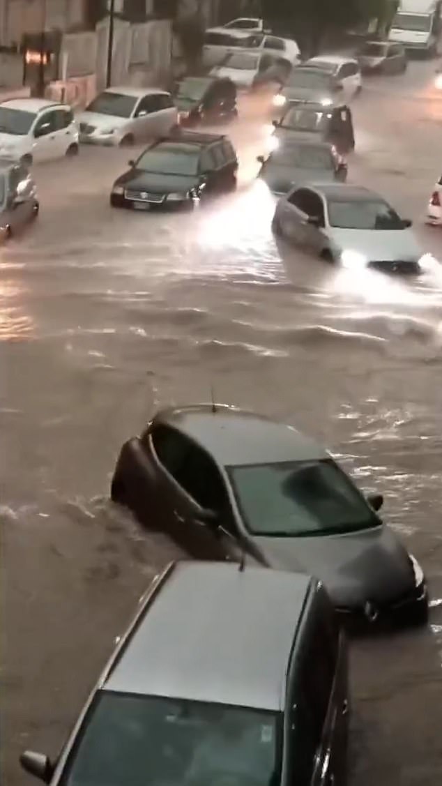
It comes after extreme rainfall flooded Ibiza with footage showing roads becoming rivers as the aftermath of Hurricane Gabrielle battered the island.
Jaw-dropping videos show streets transformed into rivers, cars swept away by murky torrents, and lightning striking as the violent weather unleashed chaos across towns and cities.
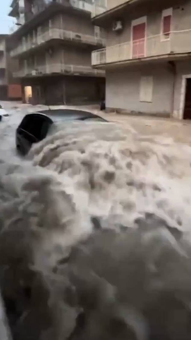
Cars floated down village streets and water engulfed vehicles
Videos circulating online show holidaymakers who travelled to the island at this time of the year to avoid the crowds complaining that their beach clubs are underwater.
The terrifying scenes are a result of the aftermath of Hurricane Gabrielle which transformed into an extratropical storm now called ex-Gabrielle, plunging the Balearic Islands, Murcia and the Valencia regions into chaos.
Britain is bracing for strong winds and torrential rain from tail-end of two hurricanes as Humberto and Imelda storm across Atlantic that are expected to land on Friday.
Storm Amy is forecast to bring 80mph winds and torrential rain to parts of the country on Friday and Saturday, the Met Office said today.
The first named storm of autumn will be a separate weather system forming to the east of Hurricanes Humberto and Imelda, which are also heading across the Atlantic.
Northern and western areas of the UK are expected to be worst hit by Storm Amy, with its development being influenced by the remnants of Humberto and Imelda.
Meteorologists said the hurricanes had accelerated the Atlantic jet stream which had contributed to the formation and intensification of Storm Amy in the ocean.
The Met Office has imposed a 31-hour yellow rain warning for western Scotland from 5pm today until the end of tomorrow, after which Storm Amy will officially arrive. A 12-hour rain warning from Friday midday to midnight is also in place for a similar area.
Dramatic footage posted to social media show roads have been turned into raging rivers
A 30-hour yellow wind warning for all of Scotland as well as North West England and North Wales then runs from 6pm on Friday until the end of Saturday. A separate 14-hour wind warning for Northern Ireland will run from 4pm Friday until 6am Saturday.
During the first rain alert, forecasters said areas could be ‘cut off by flooded roads or landslides’, while flooding could cause ‘difficult driving conditions’ and road closures.
Power cuts and loss of other services to some homes and businesses are also possible, while flooding could damage buildings and cause train cancellations.