

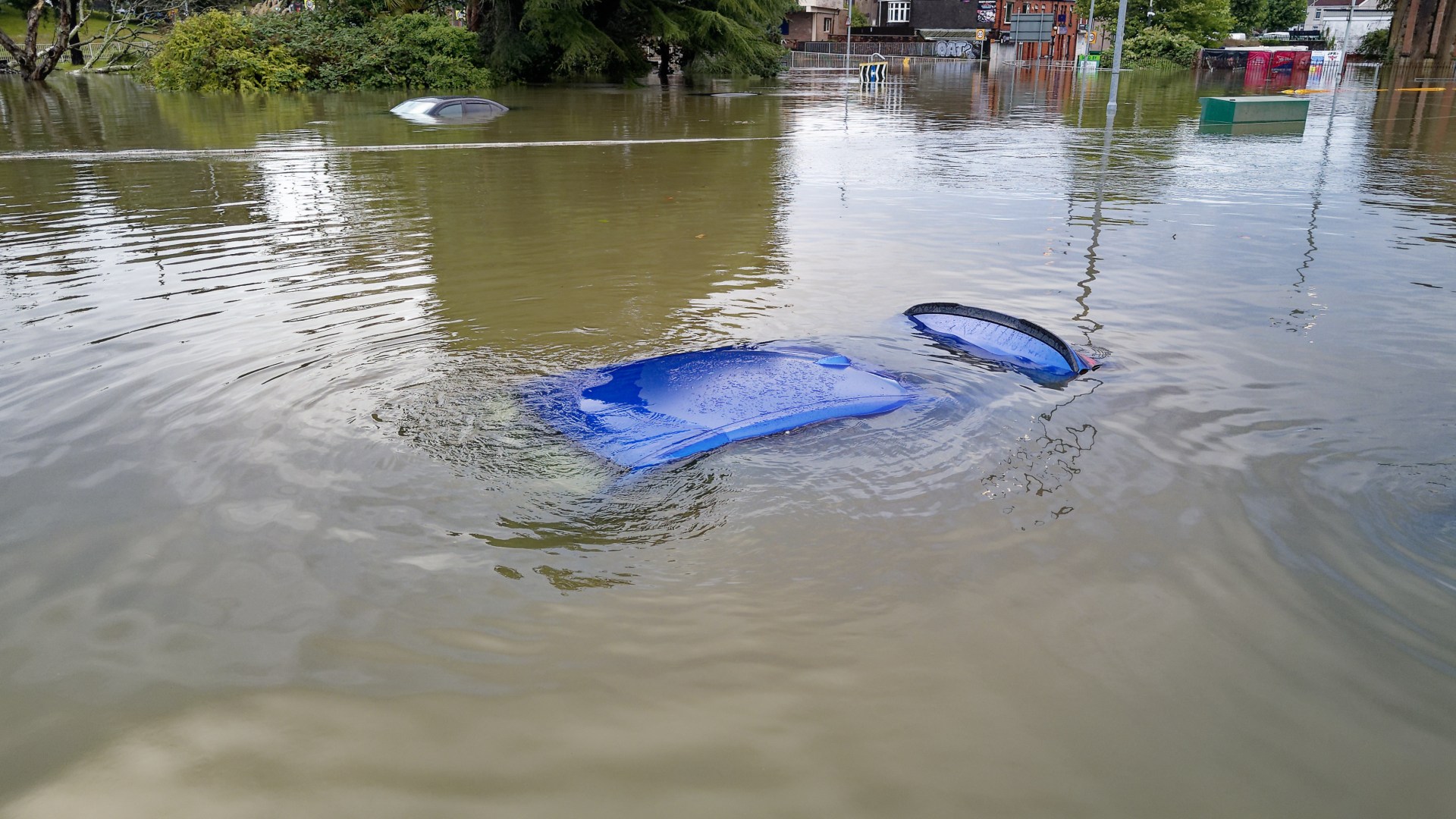
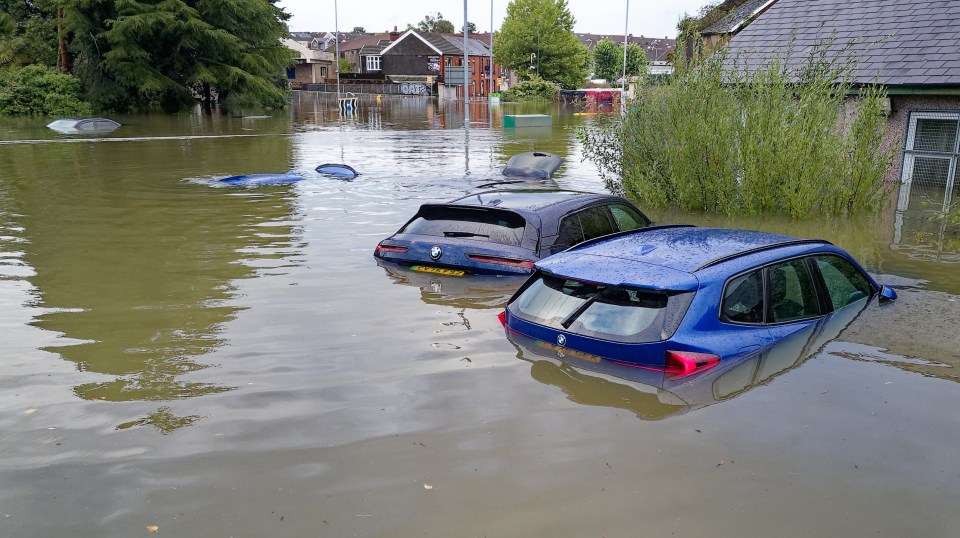
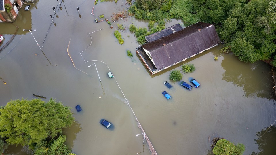
FLOODING has hit Wales with waves of water submerging cars as a trio of flood warnings are issued.
Footage from one of the main roads into the capital, Swansea, shows several motors completely submerged by flood water.
5
5
A yellow weather warning covering all of Wales was issued as torrential downpours and stormy weather threaten to drown the country.
The warning will remain in place from 8pm on Sunday until 6pm on Monday.
Meanwhile Natural Resources Wales has issued a trio of flood warnings.
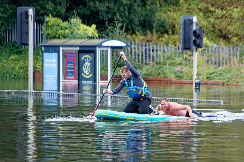
Roads have been closed after cars were seen struggling to drive through meters of floodwater.
Strong gusts of wind, reaching 70mph, battered the country today as Autumn arrived.
Brits in England and Wales were warned earlier today to expect stormy conditions and were told the nation’s transport routes could be delayed.
People travelling by plane, car, boat and train were warned that the weather would be likely to delay their journeys.
The yellow weather warning was put in place earlier, lasting from 8pm today until 6pm tomorrow and stretching from the entire south and midlands, all the way up to just below Newcastle-upon-Tyne.
The Met Office said that the stormy conditions could even knock out power in some places.
Met Office meteorologist Tom Morgan said the weather would have “low impacts in general” but added: “Nonetheless, there could be some brief kind of power interruptions and some travel disruption for the return to work on Monday morning.
“So it will be quite a windy start to the week.
“Gales certainly possible for many parts of England and Wales, perhaps even severe gales on Irish Sea coasts.
“The strongest winds are expected to be for west Wales and North West England on Monday morning, where we could see gusts of up to 65 miles per hour.”
5

5
5
The meteorologist went on: “The ground has started to become fairly wet over recent weeks and it will not take a huge amount more for there to be some surface water, potentially some flooding issues as we go towards the middle part of the week.”
In preparation for the rough weather, people have been encouraged to secure loose items outside their properties and gardens.
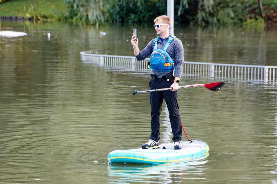
After flooding closed a number of roads in Wales emergency crews were seen wading through waist high water in high visability gear.
Crews were spotted with inflatable dinghies as they made their way along the submerged roads.
South Wales Police said the Cwmbwrla roundabout en route to Swansea was fully closed, adding that it was “expected to remain closed for some time.”
Traffic has been diverted via Pentregethin Road.
South Wales Police also responded to flooding on Goetre Fawr Road, Killay, which has now been closed.
Motorists have been instructed to take alternative routes with the flood water leaving the roads completely impassable.
UK 5-day weather forecast
Today:
Largely sunny for the Northern Isles whilst rain spreads across most other areas, heavy at times.
Turning brighter in the southwest later but with winds strengthening and coastal gales developing.
Chilly to start and remaining rather cool where cloud persists.
Sunday:
Rain moves towards northern Scotland. Elsewhere, clear spells and blustery showers, most frequent in the west.
Windy across England and Wales with coastal gales, locally severe in the west.
Monday:
Unsettled with spells of rain and showers, some heavy with hail and thunder.
Brightest conditions in the southeast, but strong and gusty winds continuing across much of England and Wales.
Tuesday to Thursday:
Winds and showers gradually easing during Tuesday but turning wet and windy again for a time on Wednesday.
Showers and sunny spells for Thursday. Often breezy and feeling rather cool.


