Parts of Britain have enjoyed some excellent weather for the time of year in recent weeks, with glorious spring sunshine and temperatures above 20C (68F).
But conditions are about to change dramatically following the country’s early taste of spring, with forecasters warning of colder and wetter conditions later this week.
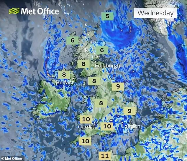
The Met Office said Wednesday will be a ‘shock to the system’ as the mercury drops to as low as -5C (23F) with heavy rain, strong winds, frost and even snow possible.
It comes after the UK recorded its warmest day of the year so far last week as thermometers reached 20.9C (69.6F) at Gogerddan in Wales on March 18.
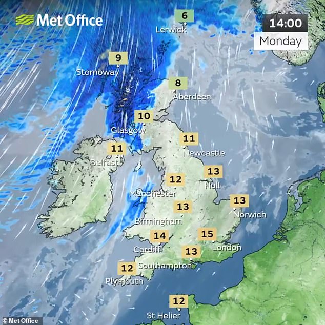
Conditions should remain fine in England and Wales today with hazy sunshine, while Scotland will experience rain and strengthening winds with possible coastal gales.
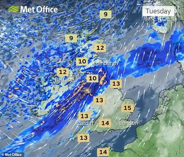
Tomorrow is expected to be wet and windy for many areas of the country, with particularly heavy and persistent rain across parts of northern England and Wales.
Blustery showers will move into Scotland and Northern Ireland, with forecasters anticipating hail and thunder as well as wintry showers over higher ground.
Wednesday will feel significantly colder across the UK with rain, sleet and hail showers expected quite widely and snow likely over higher ground in the North.

A dog waits for a drink of water from a bottle during a walk along Paignton in Devon today

People pose for photos under a cherry blossom tree at St James’s Park in London today

Hazy sunshine above the Grand Union Canal in Denham, Buckinghamshire, this morning
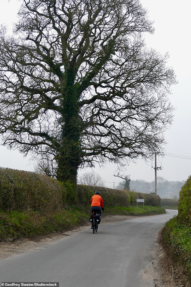
A cyclist travels on a road on a dull morning in the Oxfordshire countryside at Dunsden today
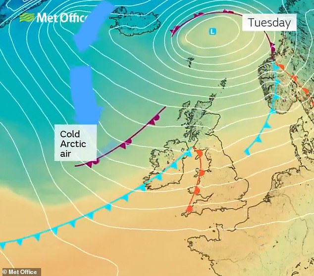
Colder air from the Arctic will push into Britain from the north-west over the coming days
Conditions elsewhere will be blustery and cold due to the wind chill, although there will be some sunshine.
Temperatures will fall during the night – potentially to -5C in rural Scotland – with a widespread frost likely for most areas and ice in the North on Thursday morning.
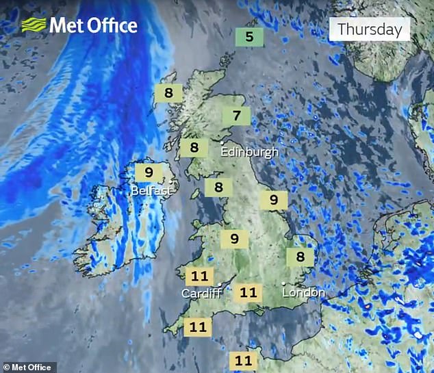
Most places will stay dry with sunny spells on Thursday, although cloud and rain is expected to push into Northern Ireland and western areas of Britain later on.
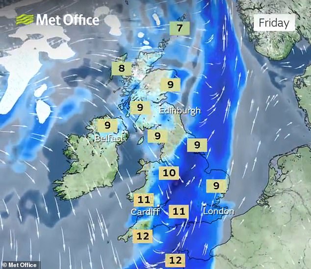
Temperatures are expected to return closer to average from Friday onwards, but forecasters said further weather systems could impact northern areas this weekend.
Met Office deputy chief forecaster Steven Keates said: ‘After a spell of mild and brighter weather, the UK will turn increasingly unsettled in the coming days.
‘A series of weather fronts will bring periods of rain, strong winds and much colder air by midweek. Wednesday could be quite a shock to the system.’
Mr Keates added that temperatures will range from 6C (43F) to 10C (50F), although conditions will feel ‘closer to low single figures for many areas in the wind’.
He continued: ‘Wintry showers are likely, especially over higher ground in the north, and a widespread frost – with icy patches for some – is possible on Wednesday night.
‘It should be a little milder again by the end of the week, with many areas seeing another spell of rain on Friday.’