

The scream of steam for long held generations in awe, as steam-powered locomotives thundered through cuttings and tunnels and over embankments, putting the march of travel onto a new level of scale and speed. The excitement of rail, the energy of builders, the trains cutting through the landscape, and the transformation they brought, to economies, societies and countries, can all be seen through maps. Railway maps were a key form of mapmaking and of cartographic use, governmental, business and public, from the early nineteenth century, and have remained so to the present. As such, they had a history in cartography that has lasted as long as that of most government mapping agencies, and longer than many.
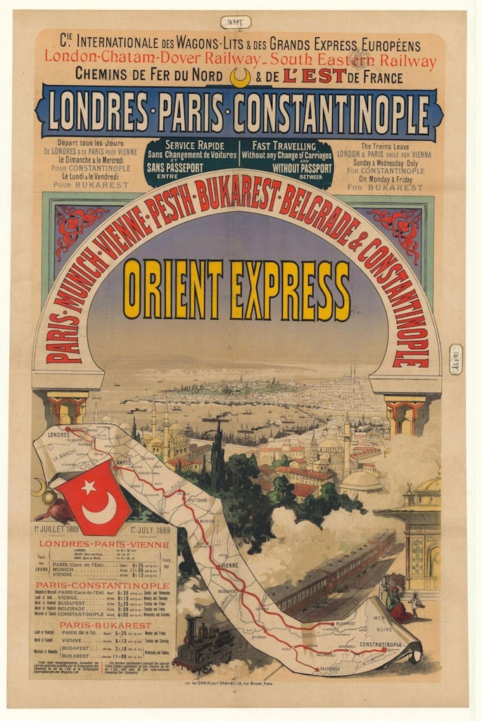
Moreover, in terms of the interaction of mapping technology and business, this is a sustained type of business. This furthermore had to engage with the public: they were crucially engaged through being passengers. Rail was not only about freight. As passengers, the public were readers and scanners of guides and maps, the latter a basis for planning journeys and a key adjunct to timetables.
Railway maps are inherent both in themselves, as guides to the development of railways, and also for what they show about developments across a range of spheres and at a number of levels including economic, social, political, military, and geopolitical developments, and from the local to the continental scales. Railway maps also show the constant adaptability of maps and graphics to differing needs and requirements, as well as the impact of particular mapping technologies, and they do with particular attention to requirements that were urgent for effectiveness and for consumer appeal.
Mapping for and of railways can not be global, for not all countries had railways, just as not all were accessible to steamships. The history of railways for example in Afghanistan or Greenland is not a matter that requires discussion, while in Iceland the sole railway was a very short line built simply to help in the improvement of the harbour at Reykjavík and leaving the legacy of a locomotive in place on display. Nevertheless, the phenomenon of steam locomotives rapidly became global, such that railways are part of human history on six continents, all of those of permanent human habitation, and should be considered accordingly.
The railway, as railroads along which horse-drawn wagons moved coal, existed before the locomotive (moving) steam engine. However, the steamship was less disruptive than the railway engine as the former meshed with an existing system of sea travel, including ports with developed facilities with trade. This was not the case with railway engines, and the change represented by the latter included the need to provide rails, stations and marshalling yards. Nevertheless, the railway engine did not confront the issues of environmental pressures and maritime conditions faced by steamships. The development of the railway engine provided the key technology for the rail revolution, and industrialisation supplied the necessary demand, capital and skills.
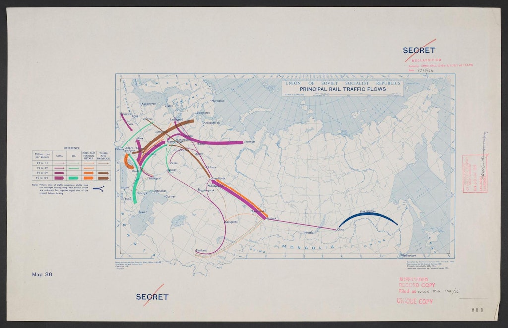
The mapping of transport links can ignore the interrelationship of systems too often presented as competing, for example between railways and canals, and between sea ports and railways. The mapping of transport history is greatly dependent on data availability, not least because quantifiable information also throws light on the qualitative nature of the system. Different indexes of density of usage can be mapped: numbers of trains or passengers per day, freight tonnage or income turnover per mile. However, it is difficult to depict improvements (rapid or slow) and periodic upgradings in existing systems, so that maps of transport links tend to place an undue weight on new routes. As a result, rail and road improvements in the first half of the twentieth century are generally underrated. This is especially the case, because there is an emphasis in mapping on the length and general direction of routes, rather than on the time taken to accomplish particular journeys.
Separately, the standard focus is on the supply-side, that of railway links. That leads to an underplaying of demand. The latter can be shown in part by material on usage; but that data does not indicate potential demand.
There is no shortage of ways in which railways can be mapped. Moreover, data can and has been presented very differently. In terms of mileage, there is the need to consider how far to include non-public railways, including those in and around mines. Linked to this comes the issue of differentiating between freight only and mixed usage lines.
As far as considering mileage, there are also questions of differentiating between track owned, track operated, and whether only part of the track was used, notably in terms of single or double tracked. Another consideration is how much emphasis to put on stations and differentiating between them, for example where they are the point of intersection between networks or as the place to change trains. Such are the competing issues involved in deciding how best to map the development of the railways across time and borders.


