

Each year in the UK, around 40,000 people with dementia will wander from their homes, get lost and go missing.
While most are soon found, those who are gone for over 24 hours face the risk of serious injury and death even within a short distance of safety.
But now, cutting-edge tech is giving search and rescue teams the edge they need to find the most vulnerable people before they come to serious harm.
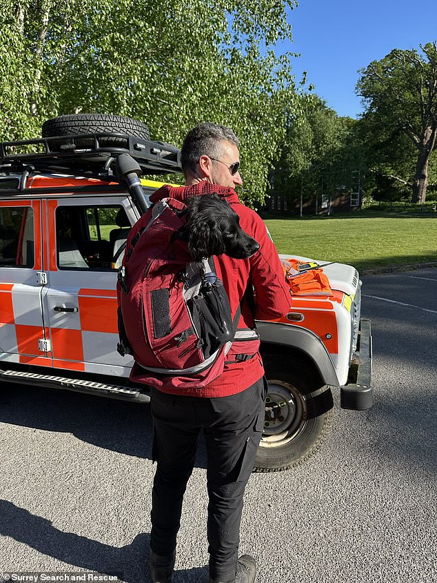
To see how this could soon be helping to find your missing loved ones, MailOnline joined Surrey Search and Rescue (SAR) as they put their skills to the test in a live training exercise.
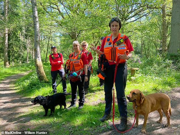
On a sweltering spring day, MailOnline met Surrey SAR’s volunteers as they geared up and prepared to track down a missing person hidden somewhere in the surrounding woodland.
With the undergrowth well over waist high in places and the missing person last seen over a day ago, the odds seemed thoroughly stacked against them.
However, tipping the scales back in their favour is SARNET: the latest software which helps search planners track down their missing person based on statistical trends.
Backed up by communications systems originally designed for the military, SARNET means the search teams can find people faster and, ultimately, save more lives.
Each year, 40,000 people with dementia will go missing in the UK. But now, search and rescue teams are using cutting-edge tech to help find them faster
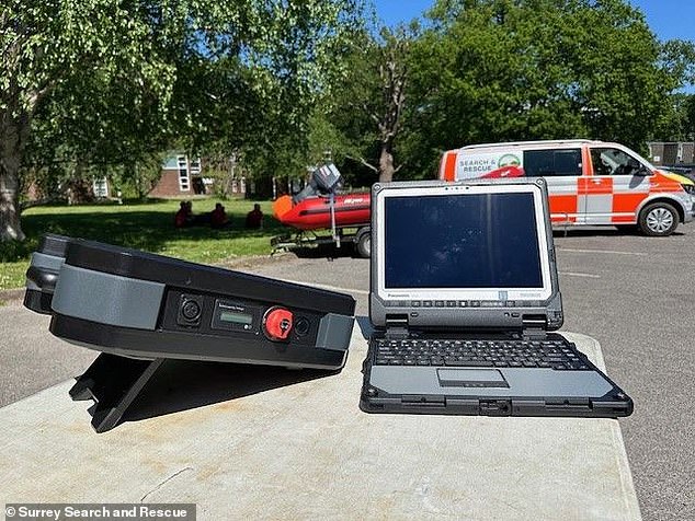
Surrey Search and Rescue (Surrey SAR) is pioneering the use of a brand-new technology called SARNET, which combines the latest software with communications systems originally designed for use by defence organisations
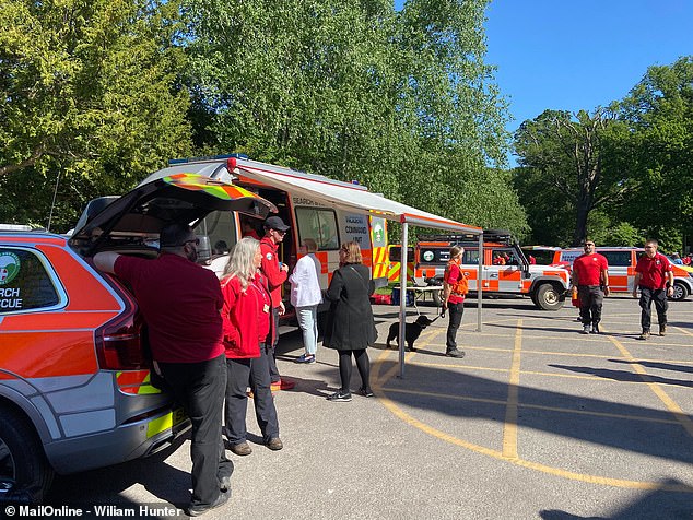
MailOnline joined Surrey SAR on Operation True North, a training exercise putting the latest tech to the test on the hunt for a missing person
Developed by British tech firm UK Connect, SARNET is essentially a way of bringing together the vast amounts of information search and rescue teams need to function.
This is critical for search and rescue teams because of the types of people they are called on to find.
Unlike mountain rescue services, where incidents are usually called in by members of the public, teams like Surrey SAR are called in by the police as specialists when someone extremely vulnerable goes missing.
A lot of the time this is someone with dementia, but it can include individuals with severe autism, mental health issues, or ‘despondent’ individuals attempting suicide.
UK Connect CEO and Surrey SAR team member PJ Farr told MailOnline: ‘The people we are looking for either don’t know they’re lost or don’t want to be found.’
Originally inspired by his work with defence organisations, Mr Farr says the idea was to take tools made for ‘finding bad guys’ and use them to find these vulnerable people.
When a missing person is reported, the police search coordinators will call up one of the search and rescue volunteers and pass on all the information they have.
Using that data, a search planner will start to create a map of the most likely locations and arrange a location for the on-call volunteers to meet and begin the search.
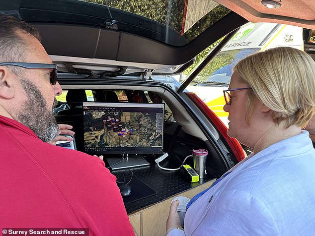
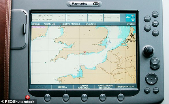
The SARSYS (Search and Rescue System) software allows search planners to take information about the missing person from the police and create predictions for where they might be based on their characteristics
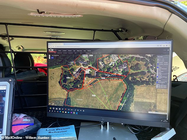
Using statistics from previous search operations, the teams identify the highest priority search areas. In this exercise, knowing that the missing person was autistic, the software suggested prioritising woodland areas and bodies of water
In the past, teams of volunteers would need to meet to collect physical copies of the maps before heading out to search an area, then come back, report their findings, get a new map, and head out again.
Sean Berry, team leader and search planner with Surrey SAR, told MailOnline: ‘We used to have a printer in the back because paper was primarily how we used to get tasked.’
All of that took up valuable time, which could mean the difference between life and death for the missing person.
But Mr Berry says a new piece of software called SARSYS has been a ‘gamechanger’, allowing teams to cut out all of these time-consuming steps.
As soon as the mission planner starts to receive data from the police, it is entered directly into the SARSYS system.
Some of that information might be basic details such as the missing person’s name, home address, and last known location.
However, using SARSYS, the planner can also start to add information that can help to predict where the person might be before the search and rescue teams have even laced up their boots.
Mr Farr explains that every type of missing person has certain statistical characteristics that narrow down the search area.
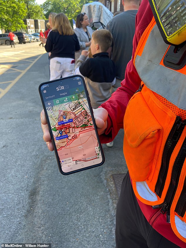
Using the SARNET (Search and Rescue Network) system, all of this information is sent directly to the volunteers’ mobile phones via a secure app
For example, people with dementia generally always go in straight lines. ‘So, they only turn when they reach a decision point like a T junction,’ explains Mr Farr.
People with severe autism, meanwhile, tend to gravitate towards areas with bodies of water as well as structures like railway bridges and motorway overpasses.
SARSYS also takes into account the specifics of the individual missing person to help build a better prediction.
For someone with dementia, this might mean referencing a person’s previous homes, favourite walking routes, or even that they happen to enjoy bird watching.
In the practice operation taking place, the fictional missing person is a young man with severe autism and ADHD.
But thanks to information provided by the police and the parents, the model shows this person is also attracted to the woods – making the woodland’s dangerous ponds a high priority area.
Mr Farr says: ‘Every time we find someone, we upload their statistics to the central system and that helps improve the model.
‘We don’t have AI yet, but that’s obviously going to be the next step.’
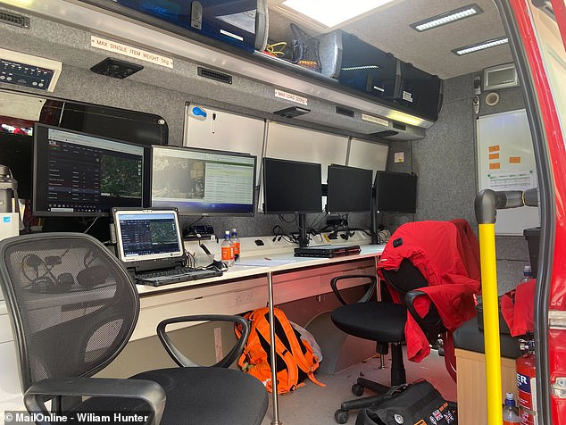
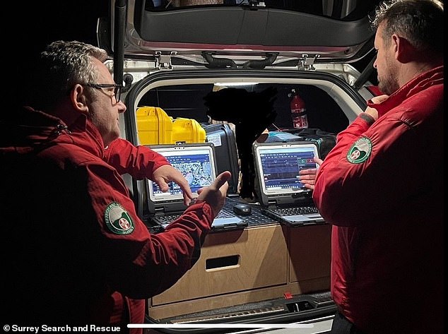
In the Incident Command Unit, mission planners use SARNET to stay in touch with teams in the field and see live updates from the volunteers
These screens show live video from phones, drone footage, real-time team locations, and statistical updates
Critically, that information is also shared in real time with every member of the search team via an app on their phones.
Each of Surrey SAR’s vehicles is fitted with an Ericsson R2100 in-vehicle router, which uses both mobile networks and low-earth orbit satellites to keep the teams in contact.
That means the search locations are sent out in real time to every team, removing the need to come back to the operations vehicle between searches and saving valuable time.
Mark Lindsay, operations officer and search planner at Surrey SAR, told MailOnline: ‘Because it’s all run through connectivity-based communications, it enables us to not only react quickly, but do it concurrently.
‘So, when we get a call from the police, the search panel can literally open their laptop at home, listen to the intelligence as it comes through and start planning straight away.’
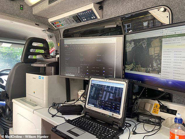
Back in the Incident Command Unit (a van filled to the brim with communications equipment, screens and laptops), search planners have all the information they need right in front of them.
Search planners can see their team’s locations in real time alongside live video feeds from the volunteers’ mobile phones, footage from airborne drone teams, and the latest statistical updates.
As the training operation plays out, Mr Lindsay’s screens show a series of red search areas slowly switching over to blue as the search teams tick off one area after another.
Being able to receive live updates from the search planners means that search teams and dog handlers know exactly where to go without needing to come back to the Incident Command Unit to get new updates
The new technology is allowing search teams to find missing people faster and, ultimately, save more lives
Then, less than two hours after the teams left the car park, a small dot appeared on the screen: the location of the missing person.
As the SARSYS model had predicted, they were found in the woods near a group of small structures, not far from a body of water.
Soon, Surrey SAR’s teams swarmed to the scene, loading them onto a stretcher and carrying them to the waiting support vehicle for first aid.
Thanks to this new technology, Mr Lindsay and his planners can make their responses that much more efficient and get rescuers to a missing person faster than ever before.
While saving a few minutes here and there might not sound important, when it comes to a missing person, every moment counts.
Although this is just a drill, were this a real scenario, every extra minute spent printing maps and sharing screenshots of locations is another minute a vulnerable person is in danger.
So, for search and rescue teams like Surrey SAR, saving time means saving lives.
HOW DOES GPS WORK?
The Global Positioning System (GPS) is a network of about 30 satellites orbiting the Earth at an altitude of 20,000 km (12,000 miles).
The system can pinpoint your location anywhere on Earth.
The system was originally developed by the US government for military navigation but now anyone with a GPS device, be it a SatNav, mobile phone or handheld GPS unit, can receive the radio signals that the satellites broadcast.
Wherever you are on the planet, at least four GPS satellites are ‘visible’ at any time.
The Global Positioning System (GPS) is a network of about 30 satellites orbiting the Earth at an altitude of 20,000 km (12,000 miles)
Each one transmits information about its position and the current time at regular intervals.
These signals, travelling at the speed of light, are intercepted by your GPS receiver, which calculates how far away each satellite is based on how long it took for the messages to arrive.
Once it has information on how far away at least three satellites are, your GPS receiver can pinpoint your location using a process called trilateration.
Trilateration is a sophisticated version of triangulation, though it does not use the measurement of angles in its calculations.
Data from a single satellite provides a general location of a point within a large circular area on the Earth’s surface.
GPS satellites have atomic clocks on board to keep accurate time. General and Special Relativity however predict that differences will appear between these clocks and an identical clock on Earth.
General Relativity predicts that time will appear to run slower under stronger gravitational pull – the clocks on board the satellites will therefore seem to run faster than a clock on Earth.
Credit: Physics.org


