Storm Ingrid struck Britain with 60mph gusts, heavy downpours and large waves today as hundreds of flood alerts were activated amid rail line shutdowns.
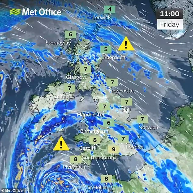
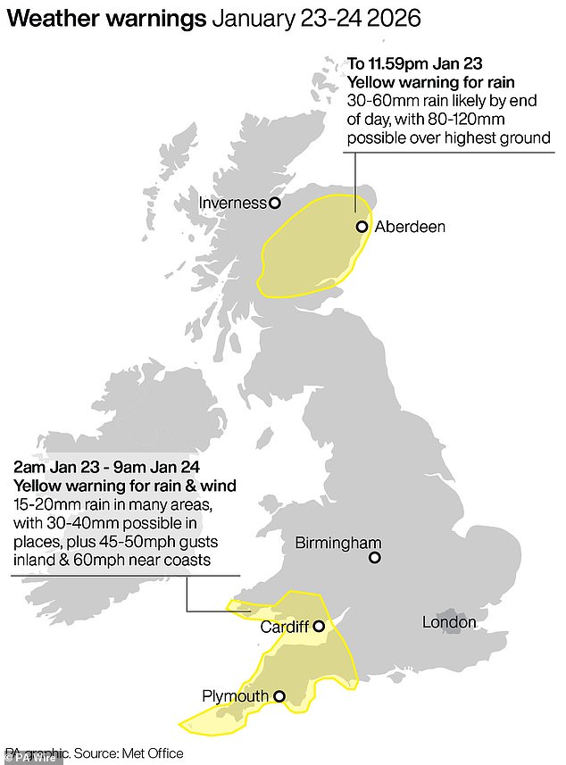
The Met Office issued a 31-hour yellow weather warning for wind and rain for South West England and South Wales running from 2am today until 9am tomorrow.
The first band of rain from the storm, named by Portuguese weather service IPMA, will bring up to 20mm (0.7in) in a few hours on already saturated ground.
A drier interlude will follow before further bands of heavy rain push north into the warning area through the afternoon and into the evening, causing flooding.
Forecasters said they expect a further 20mm (0.7in) of rain to fall widely across the region by tomorrow morning, with up to 40mm (1.6in) possible in places.
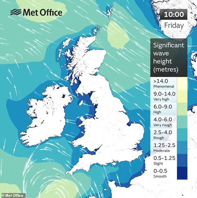
This second period of rain will be accompanied by strong winds, coastal gales and large waves – with gusts of 45 to 50mph inland and up to 60mph near coasts.
Coastal routes and sea fronts in the area will be affected by spray and large waves, with the winds set to peak this evening before gradually easing overnight.
Meteorologists also warned of difficult driving conditions due to spray and flooding on roads, as well as power cuts and delays to trains, buses, planes and ferries.
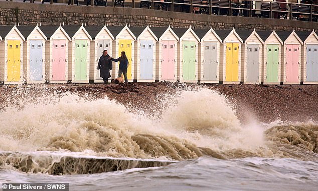
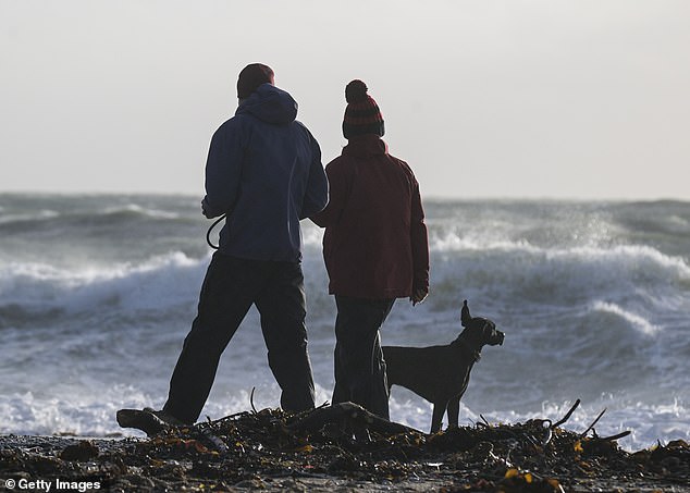
Dog walkers pass strong waves hitting the coastline of Lyme Regis in Dorset this afternoon
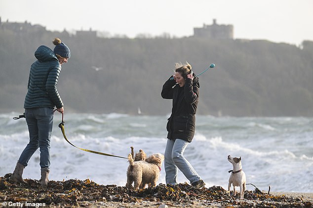
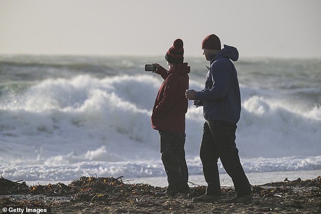
Dog walkers in strong winds at Gyllyngvase Beach in Falmouth, Cornwall, this morning
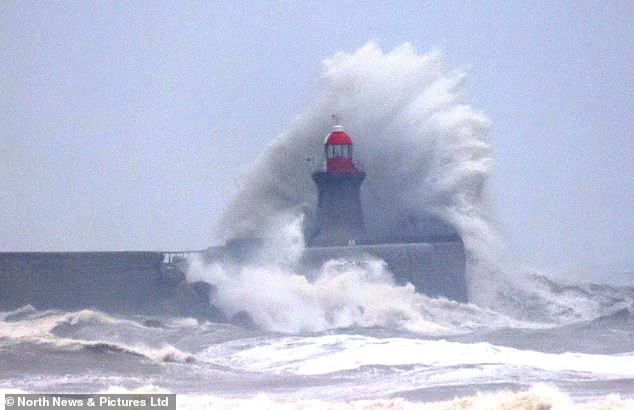
Waves crash against South Shields Lighthouse in South Tyneside this morning
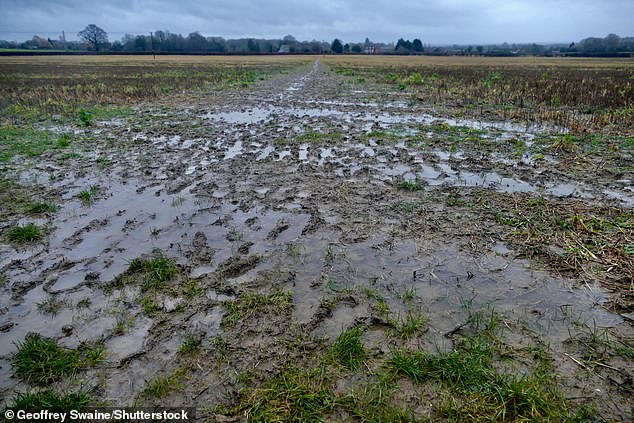
Country paths have turned into muddy quagmires today after rain in Dunsden, Oxfordshire
Flooding remains a major risk, with the Environment Agency issuing 26 warnings and 163 alerts for England. The Scottish Environment Protection Agency had 24 warnings and seven alerts active, while Natural Resources Wales issued five alerts.
Met Office chief forecaster Neil Armstrong said: ‘An area of low pressure, named Storm Ingrid by the Portuguese national weather service, will bring spells of heavy rain and strong winds across much of South West England on Friday before easing on Saturday morning.
‘The system is slow-moving but will bring more than 20mm of rain for some which is falling on saturated ground, increasing the chances of impacts.
‘In addition to rain, large waves and gusty winds are likely, especially along southern coasts, with 60mph peaks possible, with 45 to 50mph inland.’
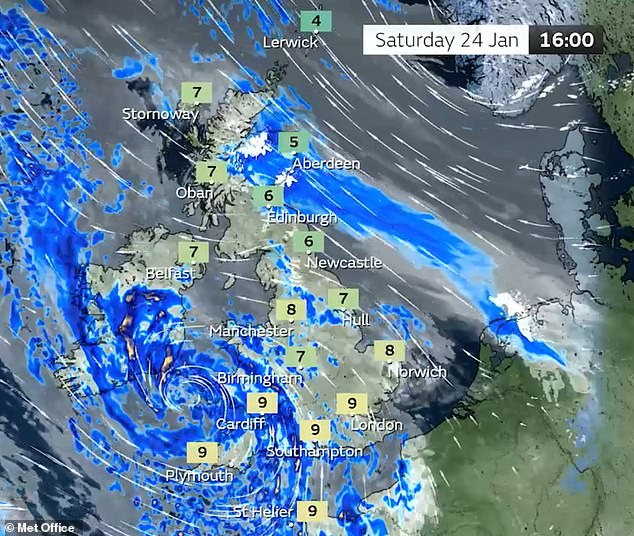
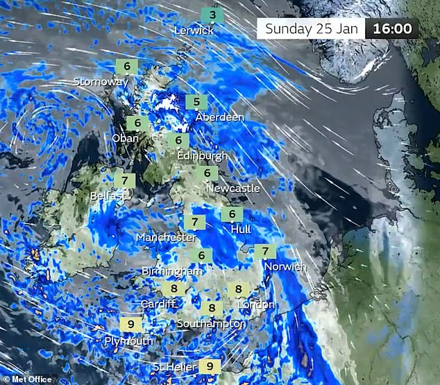
The Met Office said low pressure will remain the driving force for much of the weather this weekend, with more strong winds and rain for many places.
Forecasters have also warned of ‘wintry hazards’ next week for the north and east of the UK, with the chance of snow for some places.
CrossCountry and Great Western Railway passengers were told the line between Exeter St Davids and Newton Abbot in Devon will shut from 8.30pm tonight due to the weather.
Large waves caused by Storm Ingrid strike Gyllyngvase Beach in Falmouth, Cornwall, today
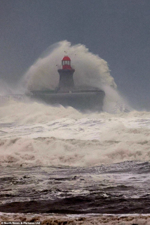
Waves crash against South Shields Lighthouse in South Tyneside this morning
Dog walkers in strong winds at Gyllyngvase Beach in Falmouth, Cornwall, this morning
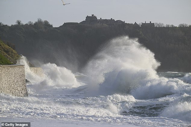
Large waves caused by Storm Ingrid strike Gyllyngvase Beach in Falmouth, Cornwall, today
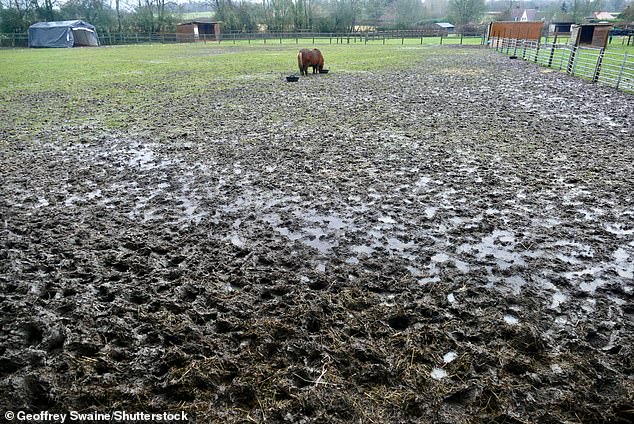
Ponies graze on their hay breakfast in a quagmire of mud in Dunsden, Oxfordshire, today
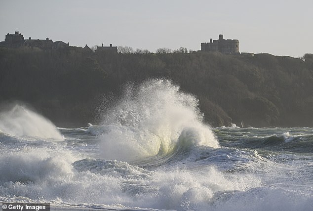
Large waves caused by Storm Ingrid strike Gyllyngvase Beach in Falmouth, Cornwall, today
It will remain closed until at least 2pm tomorrow by which time engineers will have finished inspections of the line.
From 5pm, no CrossCountry services will run between Exeter St Davids and Paignton and Plymouth, while from 8.30pm, no Great Western Railway services will run between Exeter St Davids and Newton Abbot and Paignton.
Rail replacement transport will be operating from 5pm and disruption is expected until 4pm tomorrow.
Meanwhile the line between Liskeard and Looe in Cornwall will remain closed until at least the end of tomorrow following recent heavy rain which flooded the track.
On the Isle of Wight, South Western Railway said the railway was being flooded at Ryde Pier Head which meant the station could not be served – and trains instead were starting and terminating at Ryde Esplanade.
In Scotland, areas have been deluged by heavy rain following an amber warning in place yesterday – and a yellow warning remains in force for some areas until the end of the day.
This warned of up to 120mm (4.7in) of rain over the highest ground exposed to south-easterly winds – while rain will also fall increasingly as snow in some places.
Network Rail has brought in emergency speed restrictions on some routes for safety reasons – including between Stranraer and Ayr; and between Carlisle and Glasgow Central via Dumfries, both until 12pm.
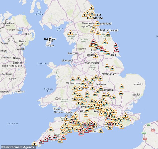
The Environment Agency has issued 26 warnings (in red) and 163 alerts (in orange) for England
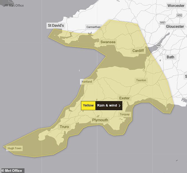
Yellow warning for South West England and South Wales from 2am today until 9am tomorrow
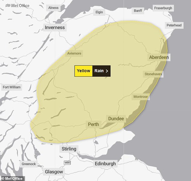
The Met Office has issued a rain warning for parts of Scotland running until the end of today
Restrictions are also in place until the same time between Glasgow Queen Street and Oban and Mallaig; between Glasgow Queen Street and Edinburgh and Inverness; between Edinburgh and Aberdeen and Inverness; and between Montrose and Aberdeen and Inverurie.
In Aberdeenshire, the Scottish Fire and Rescue Service rescued three people whose vehicles had become immobilised due to floodwater yesterday.
Two people were taken from a minibus on the B977 near Kintore at around 8.30am.
In a separate incident at around the same time near Banchory, one person was rescued from a car on the B976.
Bear Scotland has warned of disruption to roads in the affected areas, including on the A85 between Crieff and Lochearnhead in Perthshire.
The Scottish Government’s Resilience Room held a meeting discuss the flooding and how to respond.
Ferry operator CalMac said many of its services have been cancelled, with the risk of more being subject to delays or cancellation at short notice.