A powerful Arctic storm has wreaked havoc after ice buildup led to a terrifying 100-car pileup in Michigan and six inches of snow fell across New England.
The major pileup involving dozens of vehicles shut down part of Interstate 196 in Michigan after freezing temperatures and heavy snowfall on Monday morning.
Vehicles became involved in the collision, while others veered off the roadway in an attempt to avoid collision, according to police.
Video footage from speed cameras along the interstate showed the intense pileup of vehicles scattered across the snow-covered roadway.
An estimated 30 to 40 semi-trucks were said to have been involved in the terrifying chain-reaction collision, according to Michigan State Police.
‘My fiancés truck is the one hit by the semi in the ditch mine is the white explorer next to it. We saw all the semis coming from the back of us and quickly decided to drive into the ditch rather than being hit. So scary. Glad you’re ok,’ one person involved in the pileup said on Facebook.
‘It was the scariest thing to hear and watch,’ she added.
The Ottawa County Sheriffs Office said stranded motorists would be transported off the roadway using buses and taken to Hudsonville High School.
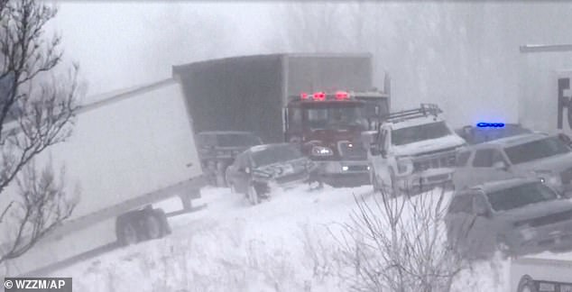
The major pileup involving some 100 vehicles such down part of Interstate 196 in Michigan after freezing temperatures and heavy snowfall on Monday morning
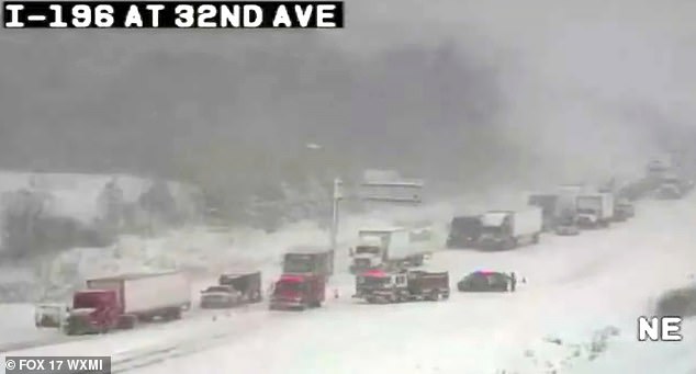
Video footage from Chicago and Midwest Storm Chasers showed the intense pileup of vehicles scattered across the snow-covered roadway
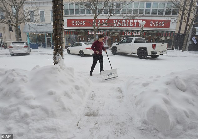
A resident clears a Michigan sidewalk on Thursday
Although there were no reported fatalities, motorists that remain stuck have been advised to remain in their vehicles. The sheriff’s office told Fox Weather that some minor injuries were sustained.
Lake-effect snow caused a domino reaction at around 10.20am, according to the sheriff’s office. Heavy snow blew across roadways, affecting visibility with winds of up to 40mph, the outlet reported.
MSP said on social media that ‘road conditions are treacherous,’ and advised drivers to slow down.
‘Blowing winds and blinding snow are creating dangerous travel conditions,’ MSP wrote.
On Friday, New York drivers were involved in a frightening 30-car pileup on Interstate 81 as seven people were rushed to hospital at around 2.20pm.
Icy and snowy conditions were blamed for the domino-effect collision, KY3 reported.
Last Wednesday, around 30 vehicles were involved in a pileup in Indiana following snowy and icy conditions.
One of the drivers of a semi-truck became trapped for hours before being freed and transported to hospital, WANE reported. Several injuries resulted from the crash but no fatalities were reported, according to the outlet.

On Friday, New York drivers were involved in a frightening 30-car pileup on Interstate 81 as seven people were rushed to hospital at around 2.20pm

Icy and snowy conditions were blamed for the domino-effect collision leading to the pileup in Lafayette
The Michigan roadway was littered with cars, including a snow plow truck, as snowy and icy conditions battered New England over the weekend.
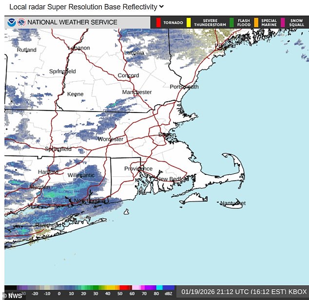
Around six inches of snow fell as Arctic temperatures are blowing through, with one of the biggest snowstorms of the season hitting on Sunday night.
Temperatures on Monday night are set to drop significantly, with temperatures floating in the teens by Tuesday morning across southern New England.
The National Weather Service issued an advisory on Monday that ‘travel is not recommended’ into the afternoon.
Rob Shackelford, a meteorologist with The Weather Channel, said that snowfall would be accompanied by ‘gusts approaching 40 mph creating near-blizzard conditions.’
AccuWeather reported a shift in the jet stream, stretching the polar vortex over the United States.
‘While the cold resulting from this setup will ebb and flow, it will generally persist well into the new week,’ AccuWeather meteorologist Joe Lundberg said.
‘During the middle to latter part of this week, the jet stream will take on a more west-to-east pattern. That may ease the harshest cold for a time, but it could also allow one or two storms to spread snow and ice across a broad area of the Central and Eastern states.’
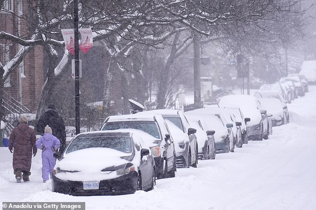
Arctic air from Canada, winter conditions seen above in Toronto, is set to sweep down over the weekend, with the southern storm whipping up toward the Mid-Atlantic states
Arctic air from Canada is set to sweep down over the weekend, with the southern storm whipping up toward the Mid-Atlantic states
Cold temperatures are expected across North and South Dakota, Nebraska, Minnesota to the Northeast into the end of January.
According to AccuWeather, the freezing temperatures will keep ice around and the weather pattern will ‘likely persist’ across the country, with the potential to strengthen in February.
‘Our long-range forecast for February calls for below-average temperatures across much of the eastern two-thirds of the nation, with the biggest departures from normal in the Midwest,’ Lundberg said.
‘For areas west of the Rockies, above-historical-average temperatures are in store with the greatest departures in the Southwest.’
Arctic air from Canada is set to sweep down over the weekend, with the southern storm whipping up toward the Mid-Atlantic states.
Forecasts predict freezing temperatures of the season should the Arctic air win out, and while the southern storm will bring slightly warm temperatures it is predicted to be a major winter storm.
Temperatures are looking to barely get above freezing, as temperatures are floating in the teens and single digits with a bitter wind chill.
Boston saw its biggest snowstorm of the season on Sunday night, with the following seven-days expected to reach single digit temperatures.
In the South, a powerful storm is expected to leave dozens of of states in snow or ice. Around a foot of snow is expected in parts of Arkansas, Tennessee Valley, Virginia and Maryland.
Snowy conditions even reached parts of Georgia and Florida, with more than 0.1 inches of snow. Marking the first recorded time some locations have seen two consecutive years of winter snow, Fox Weather reported.