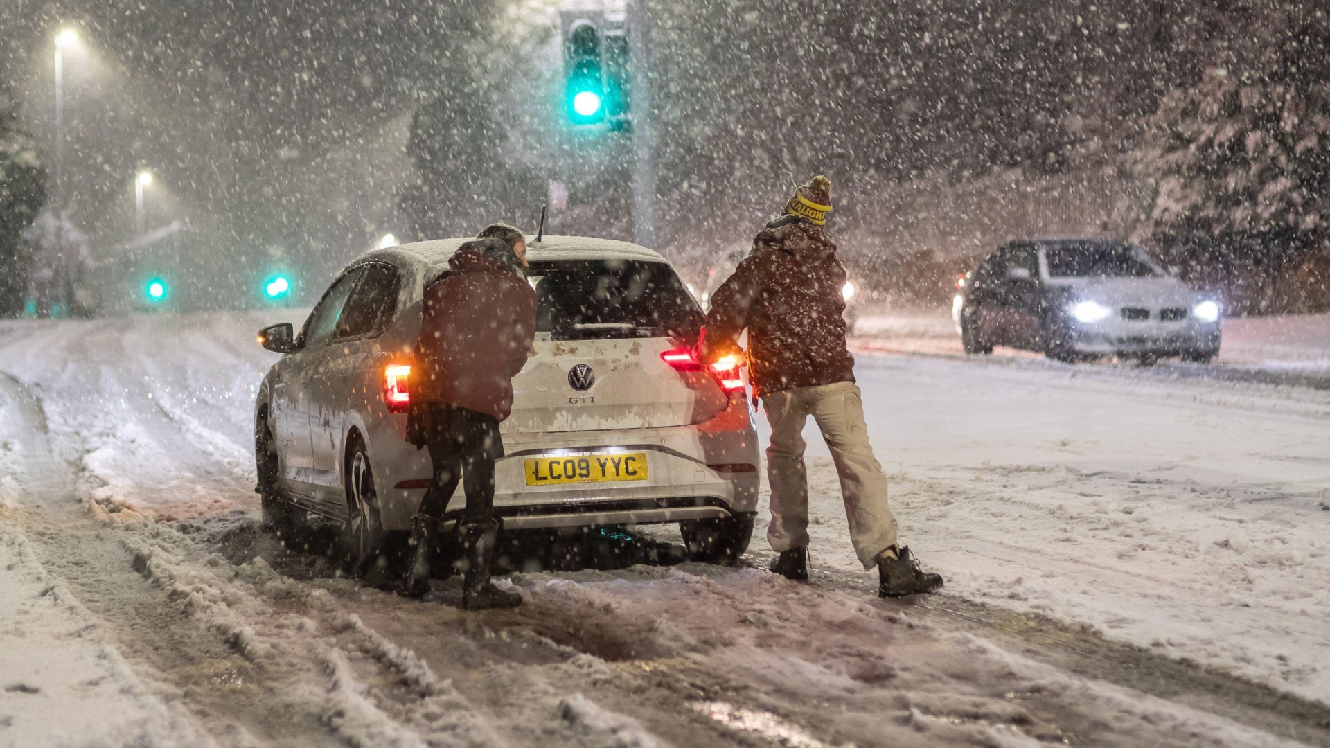
THE UK’S first storm of 2026 has caused motorways to close, flights to be cancelled and tens of thousands of homes to lose power.
According to the National Grid’s map of outages, Storm Goretti has led to almost 71,500 properties losing power across England and Wales during its height.
What is Storm Goretti?
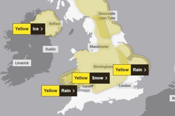
The storm hit the UK on Thursday afternoon and has caused yellow and amber weather warnings for snow, wind, rain and ice all over the country.
Officials in the West Midlands have warned that some parts of England should be prepared to endure their “worst snowfall in a decade.”
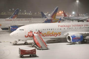
More than 50 flights arriving and departing Heathrow airport have been cancelled by British Airways due to the storm.
And a section of the M1 has been closed between junction 28 Mansfield and junction 29 Chesterfield after a lorry crash early this morning.
Read More on Storm Goretti
Yesterday, the Met Office issued a rare red weather warning in Cornwall and the Isles of Scilly, which are where the storm’s effects were being worst felt.
Gusts of 99mph were recorded at St Mary’s Airport on the Isles of Scilly and 90mph winds were recorded in Culdrose, Cornwall, as the gale force gusts brought down power lines and trees.
Around 62,000 properties remain without power across the UK but the National Grid has stated it will work “tirelessly” today to restore power across the network.
When will Storm Goretti end?
According to the latest update from the Met Office, this freezing, miserable weather won’t continue for much longer.
Storm Goretti is on its way out, but will still be present until around 12pm on Friday in large parts of Scotland and the North East.
The South West of England, on the other hand, has now seen the worst of the storm.
Whereas a yellow weather warning for snow will be present until around midday for a large portion of central England and Wales.
Another yellow warning for rain is in place for Norfolk and areas of eastern England and will last from around 6pm to 9pm tonight.
The Met Office website added: “Storm Goretti’s influence will wane on Friday evening as the system moves to the east of England.
“There will be a short-lived interlude of calmer weather for many on Saturday with rain showers easing, cloud for those in the east, and sunny spells possible elsewhere.
“However, by Sunday further unsettled weather will move in from the west. As milder Atlantic air tries to displace the cold air over the UK it brings a risk of some further widespread snowfall and strong winds in the north of the UK and rain further south.
“There is still some uncertainty in the detail for the second part of the weekend so it’s important to stay up to date with the forecast.”