
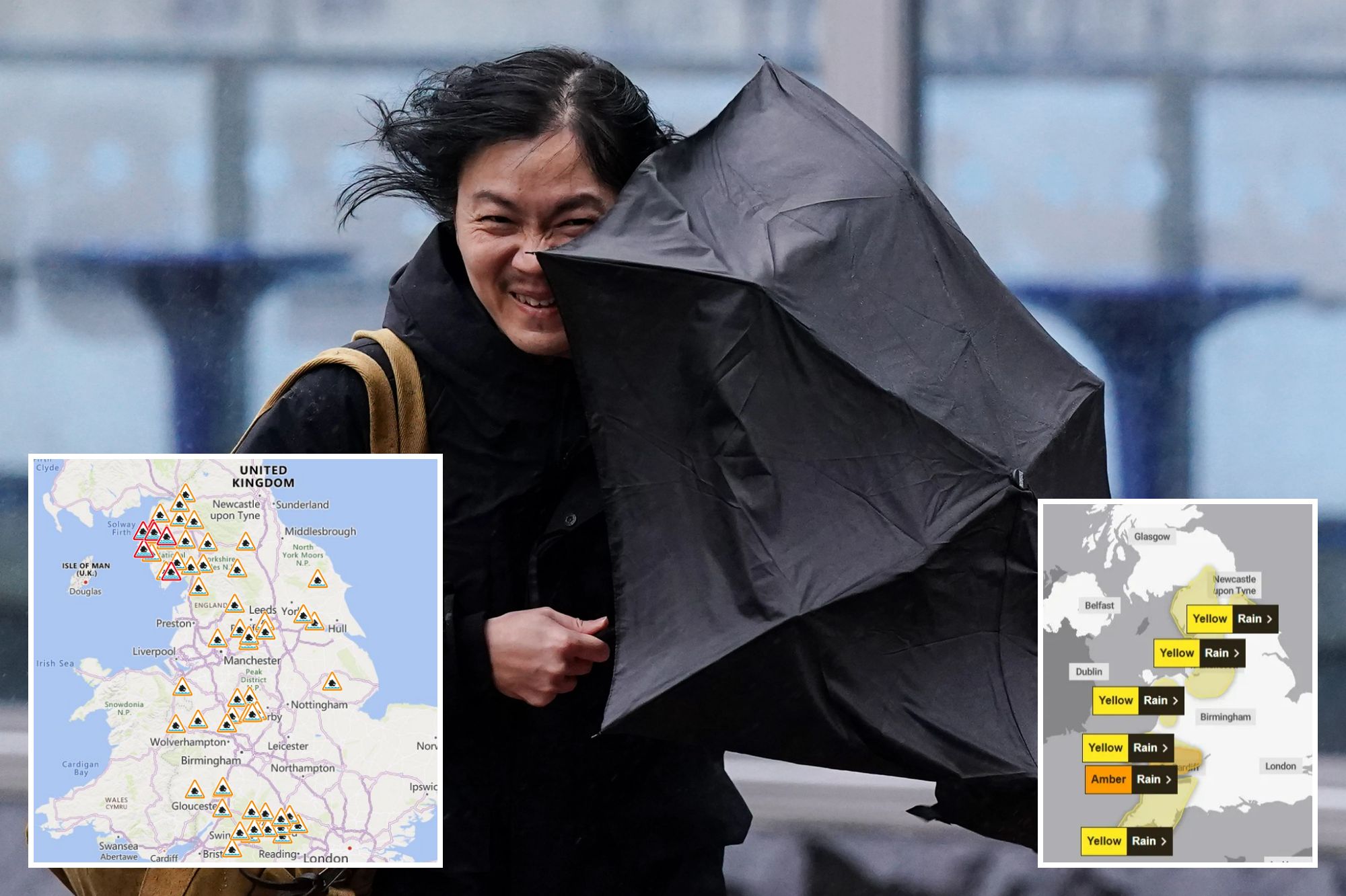
HALF a month’s rain is forecast to fall in just 24 hours – with the Met Office warning of travel chaos as 78 flood alerts are issued.
An amber weather warning for rain remains for part of the Lake District and southern Wales, but the warning level has been reduced in southern Scotland.
Dumfries and Galloway, the Scottish Borders and South Lanarkshire had been braced for amber-level rain on Sunday morning.
A yellow warning for rain remains in place for the region, and across Glasgow and Scotland’s west coast, north-west England including Manchester, north-west Wales, and Belfast.
The amber warning for rain centred on Keswick, in Cumbria, is expected to lift at 6pm this evening.
An amber warning for South Wales stretching from east of Swansea to St David’s will be in place from 3am to 9am on Monday.

Communities in Cumbria have been warned they could be cut off by floodwater, and that “deep floodwater is likely, causing a danger to life”.
A Met Office warning said: “Totals will be highest across Cumbria where over 200mm could accumulate over 48 hours where a separate amber warning has been issued. Strong southwesterly winds are also likely at times.”
Flooding was anticipated in many regions due to heavy rainfall, which affected rail services on the TransPennine Express on Sunday.
Another yellow warning for rain, covering Glasgow and the west coast, was forecast to begin at noon on Sunday and to lift just before midnight, and the Met Office said that weekend accumulation could rise “to 100mm in the wettest spots”.
It said: “There is a small chance of fast flowing or deep floodwater causing danger to life.”
There is also a possibility of flooding in Dolgellau, in Wales, and in counties Armagh, Londonderry and Tyrone in Northern Ireland, where it was warned that “50mm could accumulate across higher ground”.
A spokesperson for the TransPennine Express said: “The Met Office has issued severe weather warnings across Cumbria on Sunday 14 and Monday 15 December, with heavy rain and potential flooding.
“This will affect services running between Preston and Edinburgh/Glasgow Central in both directions.”
A spokesperson for Police Scotland said: “A yellow weather warning for rain also remains in place until midnight tonight for much of Scotland, including central, Tayside, Fife, Highlands and Eilean Siar, the Lothians and Borders and Strathclyde.
“Please drive to the conditions, spray can reduce driver visibility and be aware of increased stopping distances.
“In wet weather, stopping distances will be at least double those required for stopping on dry roads
“Driving through areas of flooding can result in catastrophic damage to your vehicle.
“It may also result in the road becoming blocked with recovery required and may delay emergency services and road maintenance workers.”
Sarah Cook, flood duty manager at the Environment Agency, said: “Heavy, persistent rainfall means significant river and surface water flooding impacts are probable in Cumbria today and into Monday.
“These impacts are also possible more widely across the north of England and parts of the Midlands.
“Minor river and surface water flooding impacts are also possible in the south west of England on Monday.
“Environment Agency teams are out on the ground, taking action to reduce the impact of flooding and support those communities affected.
“We urge people not to drive through flood water – it is often deeper than it looks and just 30cm of flowing water is enough to float your car.”
Floods minister Emma Hardy said: “I’m in continual contact with the Environment Agency as heavy rainfall is forecast for parts of the north of England, especially Cumbria, today and on Monday.
“We’re co-ordinating with local authorities and emergency services to keep communities safe.
“I urge people to follow local advice, sign up for flood warnings, and stay up to date with the latest information.”(add
A Met Office spokesperson said: “We’ve got numerous severe weather warnings in place through the rest of Sunday and into Monday, and some of those warnings continue into Tuesday.
“So, over the next 24 to 36 hours, parts of the UK, particularly the west, will see a significant amount of rain.”
The spokesperson said parts of Cumbria had seen more than 200mm of rain since midday on Saturday, which they said was “around half a month’s worth of rain having fallen in the space of just over 24 hours”.
The spokesperson continued: “In parts of Cumbria and south and west Wales we could see another 100mm of rain falling in the next 24 hours or so, and that’s falling on saturated ground.
“We’ve had a very wet November and start to December. So, travel disruption, flooding, and possible flooding of businesses and homes over the next day or two could be quite significant.
“It’s worth paying close attention to the latest situation both on the Met Office website, and also if you have travel plans over the next few hours and few days to come.”
5-day weather forecast
Today:
Heavy rain will linger for much of the day across northern England, Wales and southwest England. Flooding likely in places.
Dry elsewhere, with the best of the sunnier moments across Scotland and Northern Ireland.
Breezy and mild in the south.
Tonight:
The rain will continue across parts of England and Wales this evening, edging slowly east overnight. Dry elsewhere, with clear spells.
A patchy frost forming across Scotland and Northern Ireland.
Tuesday:
Patchy rain gradually clearing eastern England through the morning.
A dry and bright day for many, with a few blustery showers across northwest Scotland.
Feeling colder than of late.
Outlook for Wednesday to Friday:
Turning wet and windy once again through Wednesday, lingering into Thursday.
Drier and brighter for Friday, though with a scattering of showers.
Near average temperatures, mild in the far south.