
BRITS have been warned of more than a month and a half of rain expected to fall in 24 hours as yellow weather alerts are issued.
Torrential downpours are forecast across southwest England and Wales with up to 80mm of rain predicted from Monday evening onwards.
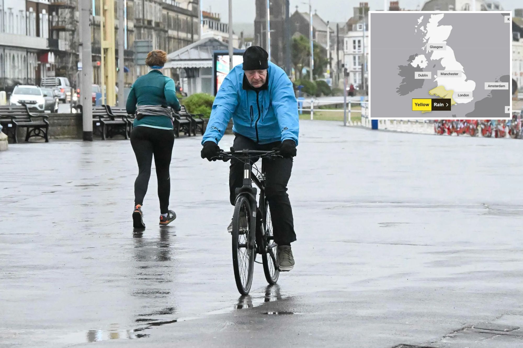
A 24-hour yellow weather warning for rain will be in place from 6pm on Monday.
The Met Office predicts up to 40mm of rain could drench some areas, while 60 to 80mm of rain is expected over Dartmoor and high ground in South Wales.
These figures would amount to more than half the average monthly rainfall in December.
Met Office meteorologists added: “There is a small chance of 80-100 mm falling over the most exposed, prone hills. Given the saturated nature of the ground, this is likely to lead to some flooding in places and transport disruption.


“Rain will also be accompanied by strengthening southerly winds, which may exacerbate impacts.”
Meanwhile the Environment Agency has issued 12 alerts where flooding is expected and 98 where it’s possible.
There is currently a yellow weather warning for rain covering Northern Ireland.
It came into force at 8am today and will end at 3pm this afternoon.
Meanwhile, on Wednesday, the Scottish Highlands will be under a yellow alert for wind.
The warning begins at 3pm on Tuesday and continues until 10am on Wednesday.
Looking ahead to next week, the Met Office also warned that a potentially deep area of low pressure could cause more difficulties.
The Met Office’s deputy chief meteorologist Steven Keates said: “A deepening area of low pressure will approach the UK from the south-west later on Monday, bringing with it heavy rain and strong winds, which are likely to affect the UK between late Monday and early Wednesday.
Flood alerts in place
THERE are 12 alerts in place where flooding is expected
- Keswick Campsite
- Plymouth Sound, Wembury Bay and tidal estuaries
- Poole Harbour at West Quay and Lower Hamworthy Quay
- River Derwent at Buttercrambe Mill
- River Derwent at Stamford Bridge – The Weir Caravan Park and Kexby Bridge
- River Ouse at York – riverside properties
- River Severn at Sandhurst and Maisemore
- South Cornwall coast from Gribbin Head to Rame Head
- South Cornwall coast from Lands End to Lizard Point excluding Mounts Bay
- South Cornwall coast from Lizard Point to Gribbin Head excluding the Tidal Fal Estuary
- South Hayling and South Eastoke seafront
- Tidal Fal Estuary
Source; The Environment Agency
“At present, the exact track, depth, and timings of this low are uncertain, which makes it harder to determine where will be most impacted by strong winds and/or heavy rain.
“This system has the potential to cause disruption, and severe weather warnings are likely to be issued over the weekend as details become clearer. We therefore urge people to keep up-to-date with the latest Met Office forecast.”
Despite heavy wind and rain, the temperatures are mild for early December.
The Met Office forecast for the remainder of the month is still unsettled with further areas of low pressure expected.
Meteorologists said it is still too early to provide an accurate forecast for the festive period.
Five day UK weather forecast
Today
Clear spells to begin across the central swathe after mist and fog clears.
Rain, sometimes heavy, will move into the southwest during the day, reaching the northeast by the evening. Drier in the southwest later. Breezy but mild.
Tonight
Cloud and rain lingering across northeastern Scotland, becoming confined to the northern isles later. Dry with clear spells elsewhere, but heavy showers in the west during the early hours.
Monday
Showers continuing across northwestern England and western Scotland. Sunny spells for much of England and Wales in afternoon. Blustery winds, with cloud and rain approaching the southwest later.
Outlook for Tuesday to Thursday
Very wet and windy weather expected for Tuesday and into Wednesday, with western Scotland seeing gale force winds. A brief settled period on Thursday. Mild throughout.